Sucre geodata
Sucre (Santander) is a seat of a second-order administrative division; located in Colombia in America/Bogota (GMT-5) time zone. With population of 1,095 people, there are 936 cities with bigger population in this country. Compared to other cities in Colombia, 57.8% of cities are located further ↓South; 70.2% of cities are located further ←West and 82.4% of cities have lower elevation than Sucre. Note1


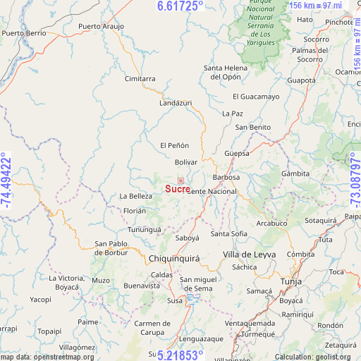
Sucre GPS coordinates[2]
5° 55' 5.988" North, 73° 47' 27.924" West
| Map corner | latitude | longitude |
|---|---|---|
| Upper-left | 6.61725°, | -74.49422° |
| Center: | 5.91833°, | -73.79109° |
| Lower-right: | 5.21853°, | -73.08797° |
| Map W x H: | 155.5×155.5 km | = 96.6×96.6mi |
| max Lat: | 13.38166° ⇑42.2% North |
| Sucre: | 5.91833° |
| min Lat: | ⇓57.8% South -4.21528° |
| min Long | Sucre | max Long |
| -81.70636° | -73.79109° | -67.06996° |
| W 70.2%⇐ | ⇒29.8% E |
Elevation
Elevation of Sucre is 2146 m = 7041 ft, and this is 996.7 m = 3270 ft above average elevation for this country.
| Max E: |
3342 m = 10965 ft | 17.6% |
| Sucre | 2146 m 7041 ft | |
| Avg. | 1149.3 m = 3771 ft | |
Min E: |
1 m = 3 ft | 82.4% |
See also: Colombia elevation on elevation.city.
Geographical zone
Sucre is located in North Torrid zone (between Equator and Tropic of Cancer). Distance of Equator is 658.1 km =408.9 mi to South.| Distance of | km | miles | from Sucre |
|---|---|---|---|
| North Pole | 9349 | 5809.2 | to North |
| Arctic Circle | 6743.1 | 4190 | to North |
| Tropic Cancer | 1947.9 | 1210.4 | to North |
| Equator | 658.1 | 408.9 | to South |


Nearby cities:
15 places around Sucre: (largest is in red/bold)
• Albania
22.3 km =13.9 mi,  217°
217°
• Barbosa
19.5 km =12.1 mi,  85°
85°
• Bolívar
8.2 km =5.1 mi,  16°
16°
• Chipatá
23.3 km =14.5 mi,  46°
46°
• El Peñón
15.4 km =9.6 mi,  350°
350°
• Florián
23.5 km =14.6 mi,  237°
237°
• Guavatá
10.9 km =6.8 mi,  67°
67°
• Güepsa
26.9 km =16.7 mi,  63°
63°
• Jesús María
4.7 km =2.9 mi,  166°
166°
• La Belleza
19.8 km =12.3 mi,  252°
252°
• Moniquirá
24.6 km =15.3 mi,  100°
100°
• Puente Nacional
13.3 km =8.3 mi,  110°
110°
• Saboyá
24.8 km =15.4 mi, 174°
• Tununguá
26.8 km =16.7 mi, 218°
• Vélez
16.8 km =10.4 mi, 50°
Sources, notices
• [Note1] Compared only with cities in Colombia existing in our database
• [Src1] Map data: © OpenStreetMap contributors (CC-BY-SA)
• [Src2] Other city data from geonames.org with taken over terms of usage.
• [Src3] Geographical zone / Annual Mean Temperature by Robert A. Rohde @ Wikipedia
