Villa de San Diego de Ubaté geodata
Villa de San Diego de Ubaté (Cundinamarca) is a seat of a second-order administrative division; located in Colombia in America/Bogota (GMT-5) time zone. With population of 20,485 people, there are 173 cities with bigger population in this country. Compared to other cities in Colombia, 54.7% of cities are located further ↑North; 69.3% of cities are located further ←West and 90.8% of cities have lower elevation than Villa de San Diego de Ubaté. Note1
Current local time in Villa de San Diego de Ubaté:
08:14 AM, WednesdayDifference from your time zone: hours


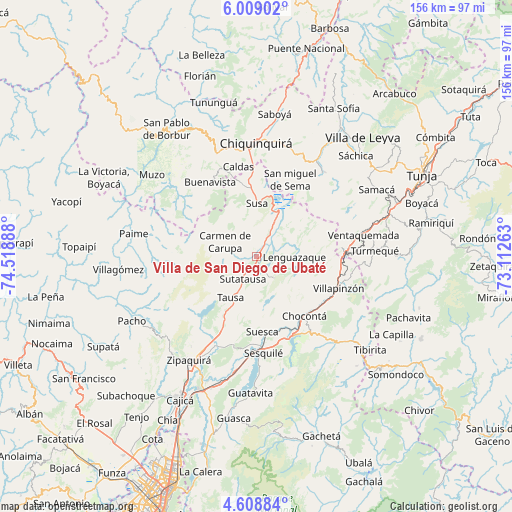
Villa de San Diego de Ubaté GPS coordinates[2]
5° 18' 33.588" North, 73° 48' 56.7" West
| Map corner | latitude | longitude |
|---|---|---|
| Upper-left | 6.00902°, | -74.51888° |
| Center: | 5.30933°, | -73.81575° |
| Lower-right: | 4.60884°, | -73.11263° |
| Map W x H: | 155.7×155.7 km | = 96.7×96.7mi |
| max Lat: | 13.38166° ⇑54.7% North |
| Villa de San Diego de Ubaté: | 5.30933° |
| min Lat: | ⇓45.3% South -4.21528° |
| min Long | Villa de San Di | max Long |
| -81.70636° | -73.81575° | -67.06996° |
| W 69.3%⇐ | ⇒30.7% E |
Elevation
Elevation of Villa de San Diego de Ubaté is 2561 m = 8402 ft, and this is 1411.7 m = 4632 ft above average elevation for this country.
| Max E: |
3342 m = 10965 ft | 9.2% |
| Villa de San Diego de Ubaté | 2561 m 8402 ft | |
| Avg. | 1149.3 m = 3771 ft | |
Min E: |
1 m = 3 ft | 90.8% |
See also: Colombia elevation on elevation.city.
Geographical zone
Villa de San Diego de Ubaté is located in North Torrid zone (between Equator and Tropic of Cancer). Distance of Equator is 590.3 km =366.8 mi to South.| Distance of | km | miles | from Villa de San Diego de Ubaté |
|---|---|---|---|
| North Pole | 9416.7 | 5851.3 | to North |
| Arctic Circle | 6810.8 | 4232 | to North |
| Tropic Cancer | 2015.6 | 1252.4 | to North |
| Equator | 590.3 | 366.8 | to South |


Nearby cities:
15 places around Villa de San Diego de Ubaté: (largest is in red/bold)
• Carmen de Carupa
10.5 km =6.5 mi,  294°
294°
• Chocontá
23.3 km =14.5 mi,  141°
141°
• Cucunubá
8.6 km =5.3 mi, 140°
• Fúquene
10.8 km =6.7 mi,  11°
11°
• Guachetá
16.6 km =10.3 mi,  59°
59°
• La Mesa
12.1 km =7.5 mi,  246°
246°
• Lenguazaque
11.5 km =7.1 mi,  91°
91°
• San Cayetano
23.5 km =14.6 mi,  277°
277°
• San Miguel de Sema
25.4 km =15.8 mi,  23°
23°
• Simijaca
21.9 km =13.6 mi,  349°
349°
• Suesca
23 km =14.3 mi,  175°
175°
• Susa
15.9 km =9.9 mi,  0°
0°
• Sutatausa
8 km =5 mi,  210°
210°
• Tausa
14.8 km =9.2 mi, 214°
• Villapinzón
26.6 km =16.5 mi,  112°
112°
Sources, notices
• [Note1] Compared only with cities in Colombia existing in our database
• [Src1] Map data: © OpenStreetMap contributors (CC-BY-SA)
• [Src2] Other city data from geonames.org with taken over terms of usage.
• [Src3] Geographical zone / Annual Mean Temperature by Robert A. Rohde @ Wikipedia
