Ábrego geodata
Ábrego (Norte de Santander) is a seat of a second-order administrative division; located in Colombia in America/Bogota (GMT-5) time zone. With population of 10,822 people, there are 288 cities with bigger population in this country. Compared to other cities in Colombia, 81.2% of cities are located further ↓South; 82.4% of cities are located further ←West and 57.7% of cities have lower elevation than Ábrego. Note1


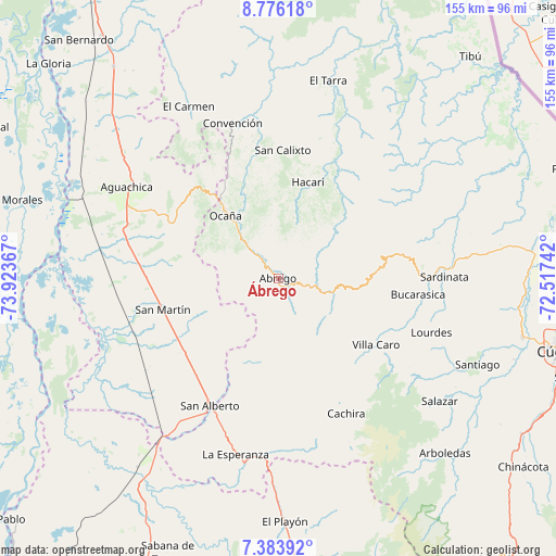
Ábrego GPS coordinates[2]
8° 4' 50.34" North, 73° 13' 13.944" West
| Map corner | latitude | longitude |
|---|---|---|
| Upper-left | 8.77618°, | -73.92367° |
| Center: | 8.08065°, | -73.22054° |
| Lower-right: | 7.38392°, | -72.51742° |
| Map W x H: | 154.8×154.8 km | = 96.2×96.2mi |
| max Lat: | 13.38166° ⇑18.8% North |
| Ábrego: | 8.08065° |
| min Lat: | ⇓81.2% South -4.21528° |
| min Long | Ábrego | max Long |
| -81.70636° | -73.22054° | -67.06996° |
| W 82.4%⇐ | ⇒17.6% E |
Elevation
Elevation of Ábrego is 1395 m = 4577 ft, and this is 245.7 m = 806 ft above average elevation for this country.
| Max E: |
3342 m = 10965 ft | 42.3% |
| Ábrego | 1395 m 4577 ft | |
| Avg. | 1149.3 m = 3771 ft | |
Min E: |
1 m = 3 ft | 57.7% |
See also: Colombia elevation on elevation.city.
Geographical zone
Ábrego is located in North Torrid zone (between Equator and Tropic of Cancer). Distance of Equator is 898.5 km =558.3 mi to South.| Distance of | km | miles | from Ábrego |
|---|---|---|---|
| North Pole | 9108.6 | 5659.8 | to North |
| Arctic Circle | 6502.7 | 4040.6 | to North |
| Tropic Cancer | 1707.4 | 1060.9 | to North |
| Equator | 898.5 | 558.3 | to South |


Nearby cities:
15 places around Ábrego: (largest is in red/bold)
• Bucarasica
39.3 km =24.4 mi,  96°
96°
• Convención
45.1 km =28 mi,  343°
343°
• Cáchira
42.3 km =26.3 mi,  153°
153°
• González
38.6 km =24 mi,  332°
332°
• Hacarí
28.1 km =17.5 mi,  16°
16°
• La Playa
14.9 km =9.3 mi,  352°
352°
• Lourdes
45.3 km =28.1 mi,  109°
109°
• Ocaña
23 km =14.3 mi,  319°
319°
• Río de Oro
29.6 km =18.4 mi, 322°
• San Alberto
40.2 km =25 mi,  208°
208°
• San Calixto
35.8 km =22.2 mi,  2°
2°
• San Martín
33.2 km =20.6 mi,  254°
254°
• Sardinata
46.2 km =28.7 mi,  89°
89°
• Teorama
40.3 km =25 mi, 349°
• Villa Caro
33.1 km =20.6 mi,  123°
123°
Sources, notices
• [Note1] Compared only with cities in Colombia existing in our database
• [Src1] Map data: © OpenStreetMap contributors (CC-BY-SA)
• [Src2] Other city data from geonames.org with taken over terms of usage.
• [Src3] Geographical zone / Annual Mean Temperature by Robert A. Rohde @ Wikipedia
