La Playa geodata
La Playa (Norte de Santander) is a seat of a second-order administrative division; located in Colombia in America/Bogota (GMT-5) time zone. With population of 1,215 people, there are 911 cities with bigger population in this country. Compared to other cities in Colombia, 81.7% of cities are located further ↓South; 82% of cities are located further ←West and 63.8% of cities have lower elevation than La Playa. Note1


La Playa GPS coordinates[2]
8° 12' 47.556" North, 73° 14' 17.772" West
| Map corner | latitude | longitude |
|---|---|---|
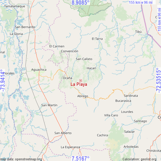
| Upper-left | 8.9085°, | -73.9414° |
| Center: | 8.21321°, | -73.23827° |
| Lower-right: | 7.5167°, | -72.53515° |
| Map W x H: | 154.8×154.8 km | = 96.2×96.2mi |
| max Lat: | 13.38166° ⇑18.3% North |
| La Playa: | 8.21321° |
| min Lat: | ⇓81.7% South -4.21528° |
| min Long | La Playa | max Long |
| -81.70636° | -73.23827° | -67.06996° |
| W 82%⇐ | ⇒18% E |
Elevation
Elevation of La Playa is 1574 m = 5164 ft, and this is 424.7 m = 1393 ft above average elevation for this country.
| Max E: |
3342 m = 10965 ft | 36.2% |
| La Playa | 1574 m 5164 ft | |
| Avg. | 1149.3 m = 3771 ft | |
Min E: |
1 m = 3 ft | 63.8% |
See also: Colombia elevation on elevation.city.
Geographical zone
La Playa is located in North Torrid zone (between Equator and Tropic of Cancer). Distance of Equator is 913.2 km =567.4 mi to South.| Distance of | km | miles | from La Playa |
|---|---|---|---|
| North Pole | 9093.8 | 5650.6 | to North |
| Arctic Circle | 6488 | 4031.5 | to North |
| Tropic Cancer | 1692.7 | 1051.8 | to North |
| Equator | 913.2 | 567.4 | to South |


Nearby cities:
15 places around La Playa: (largest is in red/bold)
• Aguachica
43 km =26.7 mi,  284°
284°
• Bucarasica
45.3 km =28.1 mi,  115°
115°
• Convención
30.5 km =19 mi,  338°
338°
• El Carmen
40.3 km =25 mi,  325°
325°
• El Tarra
43.3 km =26.9 mi,  21°
21°
• González
25 km =15.5 mi,  321°
321°
• Hacarí
15.7 km =9.8 mi,  38°
38°
• Ocaña
13.2 km =8.2 mi, 281°
• Río de Oro
18.3 km =11.4 mi,  298°
298°
• San Calixto
21.3 km =13.2 mi,  9°
9°
• San Martín
38.2 km =23.7 mi,  231°
231°
• Sardinata
50.3 km =31.3 mi,  106°
106°
• Teorama
25.4 km =15.8 mi,  347°
347°
• Villa Caro
44.4 km =27.6 mi,  138°
138°
• Ábrego
14.9 km =9.3 mi,  172°
172°
Sources, notices
• [Note1] Compared only with cities in Colombia existing in our database
• [Src1] Map data: © OpenStreetMap contributors (CC-BY-SA)
• [Src2] Other city data from geonames.org with taken over terms of usage.
• [Src3] Geographical zone / Annual Mean Temperature by Robert A. Rohde @ Wikipedia
