Ribeira Grande geodata
Ribeira Grande is a seat of a first-order administrative division; located in Cape Verde in Atlantic/Cape_Verde (GMT-1) time zone. With population of 2,950 people, there are 17 cities with bigger population in this country. Compared to other cities in Cape Verde, 95.8% of cities are located further ↓South; 95.8% of cities are located further →East and 50% of cities have lower elevation than Ribeira Grande. Note1


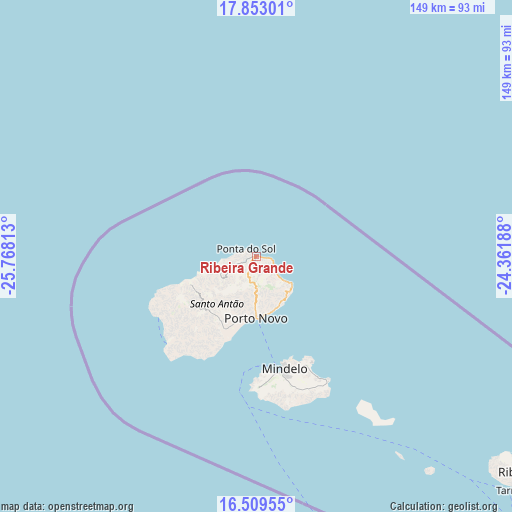
Ribeira Grande GPS coordinates[2]
17° 10' 57" North, 25° 3' 54" West
| Map corner | latitude | longitude |
|---|---|---|
| Upper-left | 17.85301°, | -25.76813° |
| Center: | 17.1825°, | -25.065° |
| Lower-right: | 16.50955°, | -24.36188° |
| Map W x H: | 149.4×149.4 km | = 92.8×92.8mi |
| max Lat: | 17.20171° ⇑4.2% North |
| Ribeira Grande: | 17.1825° |
| min Lat: | ⇓95.8% South 14.87139° |
| min Long | Ribeira Grande | max Long |
| -25.09217° | -25.065° | -22.90509° |
| W 4.2%⇐ | ⇒95.8% E |
Elevation
Elevation of Ribeira Grande is 41 m = 135 ft, and this is 76.8 m = 252 ft below average elevation for this country.
| Max E: |
480 m = 1575 ft | 50% |
| Avg. | 117.8 m = 386 ft | |
| Ribeira Grande | 41 m = 135 ft | |
Min E: |
1 m = 3 ft | 50% |
See also: Cape Verde elevation on elevation.city.
Geographical zone
Ribeira Grande is located in North Torrid zone (between Equator and Tropic of Cancer). Distance of this Northern Tropic circle is 695.4 km =432.1 mi to North.| Distance of | km | miles | from Ribeira Grande |
|---|---|---|---|
| North Pole | 8096.5 | 5030.9 | to North |
| Arctic Circle | 5490.7 | 3411.8 | to North |
| Tropic Cancer | 695.4 | 432.1 | to North |
| Equator | 1910.5 | 1187.1 | to South |


Nearby cities:
15 places around Ribeira Grande: (largest is in red/bold)
• Calheta
272 km =169 mi,  144°
144°
• Cova Figueira
267.8 km =166.4 mi,  162°
162°
• Espargos
230.5 km =143.2 mi,  101°
101°
• Igreja
251.6 km =156.3 mi, 161°
• Mindelo
33.7 km =20.9 mi, 164°
• Nova Sintra
260 km =161.6 mi,  171°
171°
• Pombas
6 km =3.7 mi,  126°
126°
• Ponta do Sol
3.6 km =2.2 mi,  306°
306°
• Porto Novo
18.1 km =11.2 mi,  179°
179°
• Ribeira Brava
103.1 km =64.1 mi, 127°
• Sal Rei
254.7 km =158.3 mi,  116°
116°
• Santa Maria
238.8 km =148.4 mi,  105°
105°
• São Filipe
261.4 km =162.4 mi, 166°
• Tarrafal
253.9 km =157.8 mi,  146°
146°
• Tarrafal de São Nicolau
101.8 km =63.3 mi, 132°
Sources, notices
• [Note1] Compared only with cities in Cape Verde existing in our database
• [Src1] Map data: © OpenStreetMap contributors (CC-BY-SA)
• [Src2] Other city data from geonames.org with taken over terms of usage.
• [Src3] Geographical zone / Annual Mean Temperature by Robert A. Rohde @ Wikipedia
