Tarrafal de São Nicolau geodata
Tarrafal de São Nicolau is a seat of a first-order administrative division; located in Cape Verde in Atlantic/Cape_Verde (GMT-1) time zone. With population of 5,039 people, there are 13 cities with bigger population in this country. Compared to other cities in Cape Verde, 66.7% of cities are located further ↓South; 70.8% of cities are located further →East and 95.8% of cities have higher elevation than Tarrafal de São Nicolau. Note1
Current local time in Tarrafal de São Nicolau:
02:33 PM, WednesdayDifference from your time zone: hours


Tarrafal de São Nicolau GPS coordinates[2]
16° 33' 58.392" North, 24° 21' 28.548" West
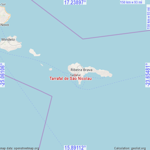
| Map corner | latitude | longitude |
|---|---|---|
| Upper-left | 17.23897°, | -25.06106° |
| Center: | 16.56622°, | -24.35793° |
| Lower-right: | 15.89112°, | -23.65481° |
| Map W x H: | 149.9×149.9 km | = 93.1×93.1mi |
| max Lat: | 17.20171° ⇑33.3% North |
| Tarrafal de São Nicolau: | 16.56622° |
| min Lat: | ⇓66.7% South 14.87139° |
| min Long | Tarrafal de Sã | max Long |
| -25.09217° | -24.35793° | -22.90509° |
| W 29.2%⇐ | ⇒70.8% E |
Elevation
Elevation of Tarrafal de São Nicolau is 4 m = 13 ft, and this is 113.8 m = 373 ft below average elevation for this country.
| Max E: |
480 m = 1575 ft | 95.8% |
| Avg. | 117.8 m = 386 ft | |
| Tarrafal de São Nicolau | 4 m = 13 ft | |
Min E: |
1 m = 3 ft | 4.2% |
See also: Cape Verde elevation on elevation.city.
Geographical zone
Tarrafal de São Nicolau is located in North Torrid zone (between Equator and Tropic of Cancer). Distance of this Northern Tropic circle is 763.9 km =474.7 mi to North.| Distance of | km | miles | from Tarrafal de São Nicolau |
|---|---|---|---|
| North Pole | 8165.1 | 5073.6 | to North |
| Arctic Circle | 5559.2 | 3454.3 | to North |
| Tropic Cancer | 763.9 | 474.7 | to North |
| Equator | 1842 | 1144.6 | to South |


Nearby cities:
15 places around Tarrafal de São Nicolau: (largest is in red/bold)
• Assomada
178.3 km =110.8 mi,  156°
156°
• Calheta
173.9 km =108.1 mi,  151°
151°
• Espargos
152 km =94.4 mi,  82°
82°
• Igreja
170.4 km =105.9 mi,  178°
178°
• Mindelo
75.4 km =46.9 mi,  298°
298°
• Pedra Badejo
181.8 km =113 mi, 150°
• Pombas
95.8 km =59.5 mi,  312°
312°
• Ponta do Sol
105.3 km =65.4 mi, 312°
• Porto Novo
90.6 km =56.3 mi, 303°
• Ribeira Brava
8.4 km =5.2 mi,  49°
49°
• Ribeira Grande
101.8 km =63.3 mi, 312°
• Sal Rei
159.7 km =99.2 mi,  105°
105°
• Santa Cruz
180.4 km =112.1 mi, 152°
• Santa Maria
154.9 km =96.3 mi,  88°
88°
• Tarrafal
157.1 km =97.6 mi, 155°
Sources, notices
• [Note1] Compared only with cities in Cape Verde existing in our database
• [Src1] Map data: © OpenStreetMap contributors (CC-BY-SA)
• [Src2] Other city data from geonames.org with taken over terms of usage.
• [Src3] Geographical zone / Annual Mean Temperature by Robert A. Rohde @ Wikipedia
