Igreja geodata
Igreja (Mosteiros) is a seat of a first-order administrative division; located in Cape Verde in Atlantic/Cape_Verde (GMT-1) time zone. With population of 477 people, there are 23 cities with bigger population in this country. Compared to other cities in Cape Verde, 75% of cities are located further ↑North; 66.7% of cities are located further →East and 75% of cities have higher elevation than Igreja. Note1


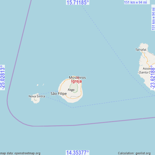
Igreja GPS coordinates[2]
15° 2' 2.004" North, 24° 19' 30" West
| Map corner | latitude | longitude |
|---|---|---|
| Upper-left | 15.71185°, | -25.02813° |
| Center: | 15.03389°, | -24.325° |
| Lower-right: | 14.35377°, | -23.62188° |
| Map W x H: | 151×151 km | = 93.8×93.8mi |
| max Lat: | 17.20171° ⇑75% North |
| Igreja: | 15.03389° |
| min Lat: | ⇓25% South 14.87139° |
| min Long | Igreja | max Long |
| -25.09217° | -24.325° | -22.90509° |
| W 33.3%⇐ | ⇒66.7% E |
Elevation
Elevation of Igreja is 15 m = 49 ft, and this is 102.8 m = 337 ft below average elevation for this country.
| Max E: |
480 m = 1575 ft | 75% |
| Avg. | 117.8 m = 386 ft | |
| Igreja | 15 m = 49 ft | |
Min E: |
1 m = 3 ft | 25% |
See also: Cape Verde elevation on elevation.city.
Geographical zone
Igreja is located in North Torrid zone (between Equator and Tropic of Cancer). Distance of this Northern Tropic circle is 934.3 km =580.5 mi to North.| Distance of | km | miles | from Igreja |
|---|---|---|---|
| North Pole | 8335.5 | 5179.4 | to North |
| Arctic Circle | 5729.6 | 3560.2 | to North |
| Tropic Cancer | 934.3 | 580.5 | to North |
| Equator | 1671.6 | 1038.7 | to South |


Nearby cities:
15 places around Igreja: (largest is in red/bold)
• Assomada
69.3 km =43.1 mi,  83°
83°
• Calheta
80.5 km =50 mi, 77°
• Cidade Velha
78.4 km =48.7 mi,  99°
99°
• Cova Figueira
16.3 km =10.1 mi,  167°
167°
• João Teves
79.1 km =49.2 mi,  87°
87°
• Nova Sintra
43.7 km =27.2 mi,  245°
245°
• Pedra Badejo
86 km =53.4 mi, 82°
• Picos
74.6 km =46.4 mi, 85°
• Praia
88 km =54.7 mi, 97°
• Santa Cruz
82.2 km =51.1 mi, 82°
• São Domingos
81.9 km =50.9 mi, 90°
• São Filipe
23.9 km =14.9 mi,  230°
230°
• Tarrafal
67.3 km =41.8 mi,  66°
66°
• Tarrafal de São Nicolau
170.4 km =105.9 mi,  358°
358°
• Vila do Maio
120.1 km =74.6 mi, 84°
Sources, notices
• [Note1] Compared only with cities in Cape Verde existing in our database
• [Src1] Map data: © OpenStreetMap contributors (CC-BY-SA)
• [Src2] Other city data from geonames.org with taken over terms of usage.
• [Src3] Geographical zone / Annual Mean Temperature by Robert A. Rohde @ Wikipedia
