Westerkappeln geodata
Westerkappeln (North Rhine-Westphalia) is a seat of a fourth-order administrative division; located in Germany in Europe/Berlin (GMT+2) time zone. With population of 11,397 people, there are 1449 cities with bigger population in this country. Compared to other cities in Germany, 75.3% of cities are located further ↓South; 79.4% of cities are located further →East and 74.7% of cities have higher elevation than Westerkappeln. Note1
Administrative division(s):
- Level 1: North Rhine-Westphalia
- Level 2: Regierungsbezirk Münster
- Level 3: Kreis Steinfurt
- Level 4: Westerkappeln


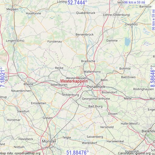
Westerkappeln GPS coordinates[2]
52° 19' 0.012" North, 7° 52' 59.988" East
| Map corner | latitude | longitude |
|---|---|---|
| Upper-left | 52.7444°, | 7.18021° |
| Center: | 52.31667°, | 7.88333° |
| Lower-right: | 51.88476°, | 8.58646° |
| Map W x H: | 95.6×95.6 km | = 59.4×59.4mi |
| max Lat: | 55.01917° ⇑24.7% North |
| Westerkappeln: | 52.31667° |
| min Lat: | ⇓75.3% South 47.40724° |
| min Long | Westerkappeln | max Long |
| 5.92978° | 7.88333° | 14.98853° |
| W 20.6%⇐ | ⇒79.4% E |
Elevation
Elevation of Westerkappeln is 64 m = 210 ft, and this is 185.1 m = 607 ft below average elevation for this country.
| Max E: |
1256 m = 4121 ft | 74.7% |
| Avg. | 249.1 m = 817 ft | |
| Westerkappeln | 64 m = 210 ft | |
Min E: |
-5 m = -16 ft | 25.3% |
See also: Germany elevation on elevation.city.
Geographical zone
Westerkappeln is located in North temperate zone (between Tropic of Cancer and the Arctic Circle). Distance of this North polar circle is 1584.1 km =984.3 mi to North.| Distance of | km | miles | from Westerkappeln |
|---|---|---|---|
| North Pole | 4190 | 2603.5 | to North |
| Arctic Circle | 1584.1 | 984.3 | to North |
| Tropic Cancer | 3211.1 | 1995.3 | to South |
| Equator | 5817.1 | 3614.6 | to South |


Nearby cities:
15 places around Westerkappeln: (largest is in red/bold)
• Belm
17.1 km =10.6 mi,  96°
96°
• Bramsche
11.9 km =7.4 mi,  30°
30°
• Georgsmarienhütte
16.8 km =10.4 mi,  139°
139°
• Hagen
14.9 km =9.3 mi,  153°
153°
• Hasbergen
10.3 km =6.4 mi, 148°
• Ibbenbüren
12.2 km =7.6 mi,  250°
250°
• Lengerich
14.5 km =9 mi,  186°
186°
• Lotte
4.3 km =2.7 mi, 148°
• Mettingen
6.8 km =4.2 mi,  270°
270°
• Neuenkirchen
11.6 km =7.2 mi,  344°
344°
• Osnabrück
12.3 km =7.6 mi,  113°
113°
• Recke
12.5 km =7.8 mi,  297°
297°
• Tecklenburg
11.8 km =7.3 mi,  203°
203°
• Voltlage
15.8 km =9.8 mi,  325°
325°
• Wallenhorst
9.8 km =6.1 mi,  67°
67°
Sources, notices
• [Note1] Compared only with cities in Germany existing in our database
• [Src1] Map data: © OpenStreetMap contributors (CC-BY-SA)
• [Src2] Other city data from geonames.org with taken over terms of usage.
• [Src3] Geographical zone / Annual Mean Temperature by Robert A. Rohde @ Wikipedia
