Ubstadt-Weiher geodata
Ubstadt-Weiher (Baden-Württemberg) is a seat of a fourth-order administrative division; located in Germany in Europe/Berlin (GMT+2) time zone. With population of 12,730 people, there are 1270 cities with bigger population in this country. Compared to other cities in Germany, 80.9% of cities are located further ↑North; 69.8% of cities are located further →East and 63.5% of cities have higher elevation than Ubstadt-Weiher. Note1
Administrative division(s):
- Level 1: Baden-Württemberg
- Level 2: Karlsruhe Region
- Level 3: Landkreis Karlsruhe
- Level 4: Ubstadt-Weiher


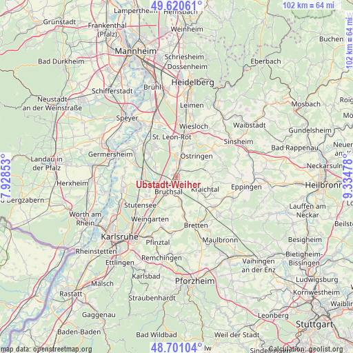
Ubstadt-Weiher GPS coordinates[2]
49° 9' 46.656" North, 8° 37' 53.94" East
| Map corner | latitude | longitude |
|---|---|---|
| Upper-left | 49.62061°, | 7.92853° |
| Center: | 49.16296°, | 8.63165° |
| Lower-right: | 48.70104°, | 9.33478° |
| Map W x H: | 102.2×102.2 km | = 63.5×63.5mi |
| max Lat: | 55.01917° ⇑80.9% North |
| Ubstadt-Weiher: | 49.16296° |
| min Lat: | ⇓19.1% South 47.40724° |
| min Long | Ubstadt-Weiher | max Long |
| 5.92978° | 8.63165° | 14.98853° |
| W 30.2%⇐ | ⇒69.8% E |
Elevation
Elevation of Ubstadt-Weiher is 129 m = 423 ft, and this is 120.1 m = 394 ft below average elevation for this country.
| Max E: |
1256 m = 4121 ft | 63.5% |
| Avg. | 249.1 m = 817 ft | |
| Ubstadt-Weiher | 129 m = 423 ft | |
Min E: |
-5 m = -16 ft | 36.5% |
See also: Germany elevation on elevation.city.
Geographical zone
Ubstadt-Weiher is located in North temperate zone (between Tropic of Cancer and the Arctic Circle). Distance of this North polar circle is 1934.8 km =1202.2 mi to North.| Distance of | km | miles | from Ubstadt-Weiher |
|---|---|---|---|
| North Pole | 4540.7 | 2821.5 | to North |
| Arctic Circle | 1934.8 | 1202.2 | to North |
| Tropic Cancer | 2860.5 | 1777.4 | to South |
| Equator | 5466.4 | 3396.7 | to South |


Nearby cities:
15 places around Ubstadt-Weiher: (largest is in red/bold)
• Bruchsal
4.9 km =3 mi,  209°
209°
• Forst
3.7 km =2.3 mi,  262°
262°
• Gondelsheim
11.7 km =7.3 mi,  170°
170°
• Graben-Neudorf
10.1 km =6.3 mi,  272°
272°
• Hambrücken
7.3 km =4.5 mi,  294°
294°
• Karlsdorf-Neuthard
8 km =5 mi,  246°
246°
• Kraichtal
7.6 km =4.7 mi,  104°
104°
• Kronau
6.6 km =4.1 mi,  359°
359°
• Malsch
10.1 km =6.3 mi,  21°
21°
• Mühlhausen
11.8 km =7.3 mi,  35°
35°
• Rauenberg
12.9 km =8 mi, 23°
• Sankt Leon-Rot
11.5 km =7.1 mi, 355°
• Waghäusel
13 km =8.1 mi,  318°
318°
• Weingarten
14.3 km =8.9 mi, 212°
• Östringen
8.5 km =5.3 mi, 43°
Sources, notices
• [Note1] Compared only with cities in Germany existing in our database
• [Src1] Map data: © OpenStreetMap contributors (CC-BY-SA)
• [Src2] Other city data from geonames.org with taken over terms of usage.
• [Src3] Geographical zone / Annual Mean Temperature by Robert A. Rohde @ Wikipedia
