Wallersdorf geodata
Wallersdorf (Bavaria) is a populated place; located in Germany in Europe/Berlin (GMT+2) time zone. With population of 6,702 people, there are 2255 cities with bigger population in this country. Compared to other cities in Germany, 86% of cities are located further ↑North; 90.2% of cities are located further ←West and 67% of cities have lower elevation than Wallersdorf. Note1
Administrative division(s):
- Level 1: Bavaria
- Level 2: Lower Bavaria
- Level 3: Landkreis Dingolfing-Landau
- Level 4: Wallersdorf, Markt


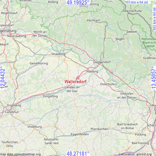
Wallersdorf GPS coordinates[2]
48° 44' 15.612" North, 12° 44' 50.784" East
| Map corner | latitude | longitude |
|---|---|---|
| Upper-left | 49.19925°, | 12.04432° |
| Center: | 48.73767°, | 12.74744° |
| Lower-right: | 48.27181°, | 13.45057° |
| Map W x H: | 103.1×103.1 km | = 64.1×64.1mi |
| max Lat: | 55.01917° ⇑86% North |
| Wallersdorf: | 48.73767° |
| min Lat: | ⇓14% South 47.40724° |
| min Long | Wallersdorf | max Long |
| 5.92978° | 12.74744° | 14.98853° |
| W 90.2%⇐ | ⇒9.8% E |
Elevation
Elevation of Wallersdorf is 335 m = 1099 ft, and this is 85.9 m = 282 ft above average elevation for this country.
| Max E: |
1256 m = 4121 ft | 33% |
| Wallersdorf | 335 m 1099 ft | |
| Avg. | 249.1 m = 817 ft | |
Min E: |
-5 m = -16 ft | 67% |
See also: Germany elevation on elevation.city.
Geographical zone
Wallersdorf is located in North temperate zone (between Tropic of Cancer and the Arctic Circle). Distance of this North polar circle is 1982.1 km =1231.6 mi to North.| Distance of | km | miles | from Wallersdorf |
|---|---|---|---|
| North Pole | 4587.9 | 2850.8 | to North |
| Arctic Circle | 1982.1 | 1231.6 | to North |
| Tropic Cancer | 2813.2 | 1748 | to South |
| Equator | 5419.1 | 3367.3 | to South |


Nearby cities:
15 places around Wallersdorf: (largest is in red/bold)
• Aholming
11.9 km =7.4 mi,  91°
91°
• Buchhofen
13.8 km =8.6 mi,  109°
109°
• Eichendorf
14.1 km =8.8 mi,  145°
145°
• Irlbach
11.5 km =7.1 mi,  1°
1°
• Landau an der Isar
8.3 km =5.2 mi,  208°
208°
• Mamming
14 km =8.7 mi,  226°
226°
• Mariaposching
11.3 km =7 mi,  19°
19°
• Oberpöring
6.9 km =4.3 mi,  125°
125°
• Oberschneiding
10.1 km =6.3 mi,  309°
309°
• Otzing
5.2 km =3.2 mi,  59°
59°
• Pilsting
8.2 km =5.1 mi,  240°
240°
• Plattling
10.4 km =6.5 mi, 64°
• Stephansposching
9.6 km =6 mi, 23°
• Straßkirchen
10.5 km =6.5 mi,  349°
349°
• Wallerfing
11.4 km =7.1 mi,  121°
121°
Sources, notices
• [Note1] Compared only with cities in Germany existing in our database
• [Src1] Map data: © OpenStreetMap contributors (CC-BY-SA)
• [Src2] Other city data from geonames.org with taken over terms of usage.
• [Src3] Geographical zone / Annual Mean Temperature by Robert A. Rohde @ Wikipedia
