Aholming geodata
Aholming (Bavaria) is a seat of a fourth-order administrative division; located in Germany in Europe/Berlin (GMT+2) time zone. With population of 2,234 people, there are 4770 cities with bigger population in this country. Compared to other cities in Germany, 86% of cities are located further ↑North; 91.6% of cities are located further ←West and 64.5% of cities have lower elevation than Aholming. Note1
Administrative division(s):
- Level 1: Bavaria
- Level 2: Lower Bavaria
- Level 3: Landkreis Deggendorf
- Level 4: Aholming


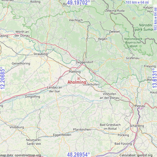
Aholming GPS coordinates[2]
48° 44' 7.512" North, 12° 54' 35.892" East
| Map corner | latitude | longitude |
|---|---|---|
| Upper-left | 49.19702°, | 12.20685° |
| Center: | 48.73542°, | 12.90997° |
| Lower-right: | 48.26954°, | 13.6131° |
| Map W x H: | 103.1×103.1 km | = 64.1×64.1mi |
| max Lat: | 55.01917° ⇑86% North |
| Aholming: | 48.73542° |
| min Lat: | ⇓14% South 47.40724° |
| min Long | Aholming | max Long |
| 5.92978° | 12.90997° | 14.98853° |
| W 91.6%⇐ | ⇒8.4% E |
Elevation
Elevation of Aholming is 318 m = 1043 ft, and this is 68.9 m = 226 ft above average elevation for this country.
| Max E: |
1256 m = 4121 ft | 35.5% |
| Aholming | 318 m 1043 ft | |
| Avg. | 249.1 m = 817 ft | |
Min E: |
-5 m = -16 ft | 64.5% |
See also: Germany elevation on elevation.city.
Geographical zone
Aholming is located in North temperate zone (between Tropic of Cancer and the Arctic Circle). Distance of this North polar circle is 1982.3 km =1231.7 mi to North.| Distance of | km | miles | from Aholming |
|---|---|---|---|
| North Pole | 4588.2 | 2851 | to North |
| Arctic Circle | 1982.3 | 1231.7 | to North |
| Tropic Cancer | 2813 | 1747.9 | to South |
| Equator | 5418.9 | 3367.1 | to South |


Nearby cities:
15 places around Aholming: (largest is in red/bold)
• Buchhofen
4.4 km =2.7 mi,  165°
165°
• Deggendorf
12.3 km =7.6 mi,  17°
17°
• Eichendorf
12.1 km =7.5 mi,  199°
199°
• Hengersberg
11.4 km =7.1 mi,  68°
68°
• Metten
13.3 km =8.3 mi,  1°
1°
• Moos
4.2 km =2.6 mi,  64°
64°
• Niederalteich
9 km =5.6 mi, 68°
• Oberpöring
7.3 km =4.5 mi,  239°
239°
• Osterhofen
9.1 km =5.7 mi,  115°
115°
• Otzing
8 km =5 mi,  291°
291°
• Plattling
5.4 km =3.4 mi,  331°
331°
• Stephansposching
12.1 km =7.5 mi,  318°
318°
• Wallerfing
6.1 km =3.8 mi, 200°
• Wallersdorf
11.9 km =7.4 mi,  271°
271°
• Winzer
12.4 km =7.7 mi,  96°
96°
Sources, notices
• [Note1] Compared only with cities in Germany existing in our database
• [Src1] Map data: © OpenStreetMap contributors (CC-BY-SA)
• [Src2] Other city data from geonames.org with taken over terms of usage.
• [Src3] Geographical zone / Annual Mean Temperature by Robert A. Rohde @ Wikipedia
