Trochtelfingen geodata
Trochtelfingen (Baden-Württemberg) is a populated place; located in Germany in Europe/Berlin (GMT+2) time zone. With population of 6,638 people, there are 2268 cities with bigger population in this country. Compared to other cities in Germany, 91.1% of cities are located further ↑North; 61.6% of cities are located further →East and 97.7% of cities have lower elevation than Trochtelfingen. Note1
Administrative division(s):
- Level 1: Baden-Württemberg
- Level 2: Tübingen Region
- Level 3: Landkreis Reutlingen
- Level 4: Trochtelfingen


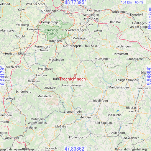
Trochtelfingen GPS coordinates[2]
48° 18' 30.348" North, 9° 14' 41.676" East
| Map corner | latitude | longitude |
|---|---|---|
| Upper-left | 48.77395°, | 8.54179° |
| Center: | 48.30843°, | 9.24491° |
| Lower-right: | 47.83862°, | 9.94804° |
| Map W x H: | 104×104 km | = 64.6×64.6mi |
| max Lat: | 55.01917° ⇑91.1% North |
| Trochtelfingen: | 48.30843° |
| min Lat: | ⇓8.9% South 47.40724° |
| min Long | Trochtelfingen | max Long |
| 5.92978° | 9.24491° | 14.98853° |
| W 38.4%⇐ | ⇒61.6% E |
Elevation
Elevation of Trochtelfingen is 695 m = 2280 ft, and this is 445.9 m = 1463 ft above average elevation for this country.
| Max E: |
1256 m = 4121 ft | 2.3% |
| Trochtelfingen | 695 m 2280 ft | |
| Avg. | 249.1 m = 817 ft | |
Min E: |
-5 m = -16 ft | 97.7% |
See also: Germany elevation on elevation.city.
Geographical zone
Trochtelfingen is located in North temperate zone (between Tropic of Cancer and the Arctic Circle). Distance of this North polar circle is 2029.8 km =1261.3 mi to North.| Distance of | km | miles | from Trochtelfingen |
|---|---|---|---|
| North Pole | 4635.7 | 2880.5 | to North |
| Arctic Circle | 2029.8 | 1261.3 | to North |
| Tropic Cancer | 2765.5 | 1718.4 | to South |
| Equator | 5371.4 | 3337.6 | to South |


Nearby cities:
15 places around Trochtelfingen: (largest is in red/bold)
• Bitz
13.4 km =8.3 mi,  237°
237°
• Burladingen
10 km =6.2 mi,  258°
258°
• Gammertingen
6.4 km =4 mi,  194°
194°
• Gomadingen
14.8 km =9.2 mi,  46°
46°
• Hayingen
17.6 km =10.9 mi,  102°
102°
• Hettingen
10.3 km =6.4 mi, 185°
• Jungingen
15.2 km =9.4 mi,  278°
278°
• Mössingen
17.8 km =11.1 mi,  307°
307°
• Neufra
8.2 km =5.1 mi,  214°
214°
• Pfronstetten
9.2 km =5.7 mi,  112°
112°
• Pfullingen
17.4 km =10.8 mi,  355°
355°
• Sankt Johann
17.8 km =11.1 mi,  24°
24°
• Unterhausen
13.5 km =8.4 mi,  3°
3°
• Veringenstadt
13.9 km =8.6 mi, 190°
• Winterlingen
16.8 km =10.4 mi, 214°
Sources, notices
• [Note1] Compared only with cities in Germany existing in our database
• [Src1] Map data: © OpenStreetMap contributors (CC-BY-SA)
• [Src2] Other city data from geonames.org with taken over terms of usage.
• [Src3] Geographical zone / Annual Mean Temperature by Robert A. Rohde @ Wikipedia
