Uchte geodata
Uchte (Lower Saxony) is a populated place; located in Germany in Europe/Berlin (GMT+2) time zone. With population of 4,892 people, there are 2861 cities with bigger population in this country. Compared to other cities in Germany, 77.4% of cities are located further ↓South; 66.6% of cities are located further →East and 81.4% of cities have higher elevation than Uchte. Note1
Administrative division(s):
- Level 1: Lower Saxony
- Level 3: Landkreis Nienburg/Weser
- Level 4: Uchte, Flecken


Uchte GPS coordinates[2]
52° 29' 59.1" North, 8° 54' 33.408" East
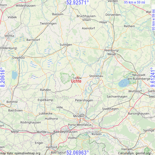
| Map corner | latitude | longitude |
|---|---|---|
| Upper-left | 52.92571°, | 8.20616° |
| Center: | 52.49975°, | 8.90928° |
| Lower-right: | 52.06963°, | 9.61241° |
| Map W x H: | 95.2×95.2 km | = 59.2×59.2mi |
| max Lat: | 55.01917° ⇑22.6% North |
| Uchte: | 52.49975° |
| min Lat: | ⇓77.4% South 47.40724° |
| min Long | Uchte | max Long |
| 5.92978° | 8.90928° | 14.98853° |
| W 33.4%⇐ | ⇒66.6% E |
Elevation
Elevation of Uchte is 43 m = 141 ft, and this is 206.1 m = 676 ft below average elevation for this country.
| Max E: |
1256 m = 4121 ft | 81.4% |
| Avg. | 249.1 m = 817 ft | |
| Uchte | 43 m = 141 ft | |
Min E: |
-5 m = -16 ft | 18.6% |
See also: Germany elevation on elevation.city.
Geographical zone
Uchte is located in North temperate zone (between Tropic of Cancer and the Arctic Circle). Distance of this North polar circle is 1563.7 km =971.6 mi to North.| Distance of | km | miles | from Uchte |
|---|---|---|---|
| North Pole | 4169.6 | 2590.9 | to North |
| Arctic Circle | 1563.7 | 971.6 | to North |
| Tropic Cancer | 3231.5 | 2008 | to South |
| Equator | 5837.4 | 3627.2 | to South |


Nearby cities:
15 places around Uchte: (largest is in red/bold)
• Bahrenborstel
10.4 km =6.5 mi,  318°
318°
• Barenburg
15.2 km =9.4 mi,  330°
330°
• Estorf
18.5 km =11.5 mi,  57°
57°
• Halle
8.7 km =5.4 mi,  174°
174°
• Kirchdorf
11.7 km =7.3 mi, 334°
• Landesbergen
15.9 km =9.9 mi,  66°
66°
• Leese
14 km =8.7 mi,  89°
89°
• Liebenau
17.2 km =10.7 mi,  47°
47°
• Pennigsehl
17.7 km =11 mi,  26°
26°
• Petershagen
14.4 km =8.9 mi,  164°
164°
• Raddestorf
6.8 km =4.2 mi,  144°
144°
• Steyerberg
11 km =6.8 mi,  44°
44°
• Stolzenau
10.8 km =6.7 mi,  79°
79°
• Varrel
18 km =11.2 mi, 318°
• Warmsen
6.2 km =3.9 mi,  220°
220°
Sources, notices
• [Note1] Compared only with cities in Germany existing in our database
• [Src1] Map data: © OpenStreetMap contributors (CC-BY-SA)
• [Src2] Other city data from geonames.org with taken over terms of usage.
• [Src3] Geographical zone / Annual Mean Temperature by Robert A. Rohde @ Wikipedia
