Langeneichstädt geodata
Langeneichstädt (Saxony-Anhalt) is a populated place; located in Germany in Europe/Berlin (GMT+2) time zone. With population of 1,520 people, there are 5840 cities with bigger population in this country. Compared to other cities in Germany, 63.9% of cities are located further ↓South; 77.9% of cities are located further ←West and 57.8% of cities have higher elevation than Langeneichstädt. Note1


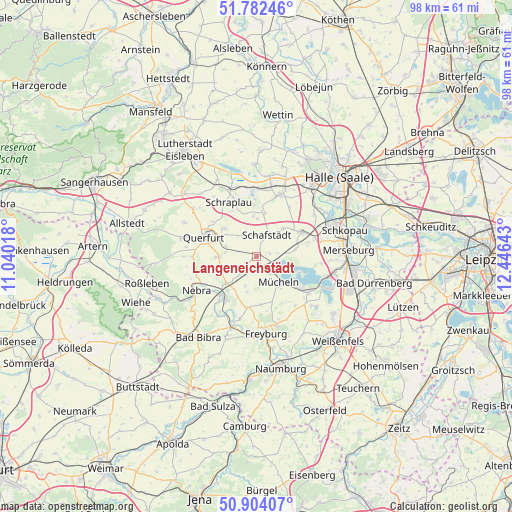
Langeneichstädt GPS coordinates[2]
51° 20' 43.332" North, 11° 44' 35.88" East
| Map corner | latitude | longitude |
|---|---|---|
| Upper-left | 51.78246°, | 11.04018° |
| Center: | 51.34537°, | 11.7433° |
| Lower-right: | 50.90407°, | 12.44643° |
| Map W x H: | 97.7×97.7 km | = 60.7×60.7mi |
| max Lat: | 55.01917° ⇑36.1% North |
| Langeneichstädt: | 51.34537° |
| min Lat: | ⇓63.9% South 47.40724° |
| min Long | Langeneichstäd | max Long |
| 5.92978° | 11.7433° | 14.98853° |
| W 77.9%⇐ | ⇒22.1% E |
Elevation
Elevation of Langeneichstädt is 169 m = 554 ft, and this is 80.1 m = 263 ft below average elevation for this country.
| Max E: |
1256 m = 4121 ft | 57.8% |
| Avg. | 249.1 m = 817 ft | |
| Langeneichstädt | 169 m = 554 ft | |
Min E: |
-5 m = -16 ft | 42.2% |
See also: Germany elevation on elevation.city.
Geographical zone
Langeneichstädt is located in North temperate zone (between Tropic of Cancer and the Arctic Circle). Distance of this North polar circle is 1692.1 km =1051.4 mi to North.| Distance of | km | miles | from Langeneichstädt |
|---|---|---|---|
| North Pole | 4298 | 2670.7 | to North |
| Arctic Circle | 1692.1 | 1051.4 | to North |
| Tropic Cancer | 3103.2 | 1928.2 | to South |
| Equator | 5709.1 | 3547.5 | to South |


Nearby cities:
15 places around Langeneichstädt: (largest is in red/bold)
• Bad Lauchstädt
9.9 km =6.2 mi,  62°
62°
• Barnstädt
7.4 km =4.6 mi,  268°
268°
• Dornstedt
7.3 km =4.5 mi,  1°
1°
• Esperstedt
9.8 km =6.1 mi,  332°
332°
• Gleina
9.8 km =6.1 mi,  189°
189°
• Karsdorf
10.2 km =6.3 mi,  215°
215°
• Klobikau
6.3 km =3.9 mi,  85°
85°
• Krumpa
8.8 km =5.5 mi,  127°
127°
• Mücheln
7 km =4.3 mi,  140°
140°
• Nemsdorf-Göhrendorf
6.5 km =4 mi, 274°
• Obhausen
8.1 km =5 mi,  309°
309°
• Schafstädt
4.5 km =2.8 mi,  27°
27°
• Steigra
7.3 km =4.5 mi,  226°
226°
• Steuden
8.3 km =5.2 mi,  11°
11°
• Öchlitz
2.8 km =1.7 mi,  151°
151°
Sources, notices
• [Note1] Compared only with cities in Germany existing in our database
• [Src1] Map data: © OpenStreetMap contributors (CC-BY-SA)
• [Src2] Other city data from geonames.org with taken over terms of usage.
• [Src3] Geographical zone / Annual Mean Temperature by Robert A. Rohde @ Wikipedia
