Nemsdorf-Göhrendorf geodata
Nemsdorf-Göhrendorf (Saxony-Anhalt) is a seat of a fourth-order administrative division; located in Germany in Europe/Berlin (GMT+2) time zone. With population of 971 people, there are 7269 cities with bigger population in this country. Compared to other cities in Germany, 63.9% of cities are located further ↓South; 76.4% of cities are located further ←West and 54.1% of cities have higher elevation than Nemsdorf-Göhrendorf. Note1


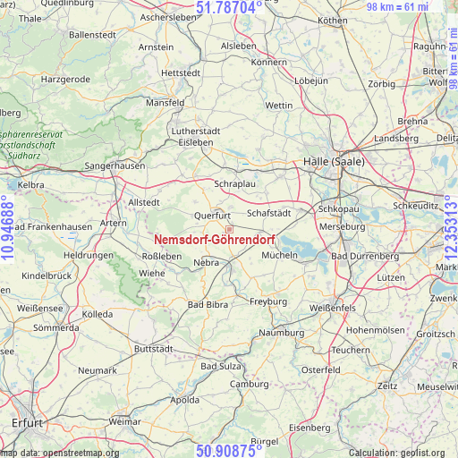
Nemsdorf-Göhrendorf GPS coordinates[2]
51° 21' 0" North, 11° 39' 0" East
| Map corner | latitude | longitude |
|---|---|---|
| Upper-left | 51.78704°, | 10.94688° |
| Center: | 51.35°, | 11.65° |
| Lower-right: | 50.90875°, | 12.35313° |
| Map W x H: | 97.7×97.7 km | = 60.7×60.7mi |
| max Lat: | 55.01917° ⇑36.1% North |
| Nemsdorf-Göhrendorf: | 51.35° |
| min Lat: | ⇓63.9% South 47.40724° |
| min Long | Nemsdorf-Göhre | max Long |
| 5.92978° | 11.65° | 14.98853° |
| W 76.4%⇐ | ⇒23.6% E |
Elevation
Elevation of Nemsdorf-Göhrendorf is 196 m = 643 ft, and this is 53.1 m = 174 ft below average elevation for this country.
| Max E: |
1256 m = 4121 ft | 54.1% |
| Avg. | 249.1 m = 817 ft | |
| Nemsdorf-Göhrendorf | 196 m = 643 ft | |
Min E: |
-5 m = -16 ft | 45.9% |
See also: Germany elevation on elevation.city.
Geographical zone
Nemsdorf-Göhrendorf is located in North temperate zone (between Tropic of Cancer and the Arctic Circle). Distance of this North polar circle is 1691.6 km =1051.1 mi to North.| Distance of | km | miles | from Nemsdorf-Göhrendorf |
|---|---|---|---|
| North Pole | 4297.5 | 2670.3 | to North |
| Arctic Circle | 1691.6 | 1051.1 | to North |
| Tropic Cancer | 3103.7 | 1928.5 | to South |
| Equator | 5709.6 | 3547.8 | to South |


Nearby cities:
15 places around Nemsdorf-Göhrendorf: (largest is in red/bold)
• Barnstädt
1.1 km =0.7 mi,  232°
232°
• Dornstedt
9.5 km =5.9 mi,  44°
44°
• Esperstedt
8.5 km =5.3 mi,  13°
13°
• Karsdorf
8.8 km =5.5 mi,  176°
176°
• Langeneichstädt
6.5 km =4 mi,  94°
94°
• Nebra
8.5 km =5.3 mi,  216°
216°
• Obhausen
4.6 km =2.9 mi,  2°
2°
• Querfurt
4.9 km =3 mi,  315°
315°
• Schafstädt
9.2 km =5.7 mi,  67°
67°
• Schmon
7.4 km =4.6 mi,  265°
265°
• Schraplau
9.8 km =6.1 mi, 7°
• Steigra
5.7 km =3.5 mi,  168°
168°
• Vitzenburg
7.8 km =4.8 mi, 226°
• Weißenschirmbach
8 km =5 mi,  239°
239°
• Öchlitz
8.4 km =5.2 mi,  110°
110°
Sources, notices
• [Note1] Compared only with cities in Germany existing in our database
• [Src1] Map data: © OpenStreetMap contributors (CC-BY-SA)
• [Src2] Other city data from geonames.org with taken over terms of usage.
• [Src3] Geographical zone / Annual Mean Temperature by Robert A. Rohde @ Wikipedia
