Schwenda geodata
Schwenda (Saxony-Anhalt) is a populated place; located in Germany in Europe/Berlin (GMT+2) time zone. With population of 616 people, there are 8739 cities with bigger population in this country. Compared to other cities in Germany, 67% of cities are located further ↓South; 67.3% of cities are located further ←West and 83.3% of cities have lower elevation than Schwenda. Note1


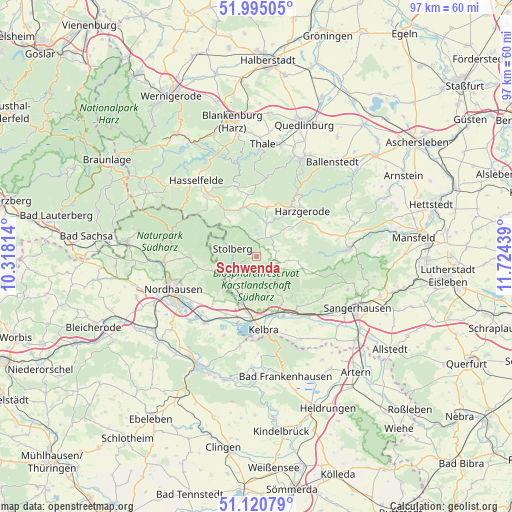
Schwenda GPS coordinates[2]
51° 33' 36.072" North, 11° 1' 16.536" East
| Map corner | latitude | longitude |
|---|---|---|
| Upper-left | 51.99505°, | 10.31814° |
| Center: | 51.56002°, | 11.02126° |
| Lower-right: | 51.12079°, | 11.72439° |
| Map W x H: | 97.2×97.2 km | = 60.4×60.4mi |
| max Lat: | 55.01917° ⇑33% North |
| Schwenda: | 51.56002° |
| min Lat: | ⇓67% South 47.40724° |
| min Long | Schwenda | max Long |
| 5.92978° | 11.02126° | 14.98853° |
| W 67.3%⇐ | ⇒32.7% E |
Elevation
Elevation of Schwenda is 456 m = 1496 ft, and this is 206.9 m = 679 ft above average elevation for this country.
| Max E: |
1256 m = 4121 ft | 16.7% |
| Schwenda | 456 m 1496 ft | |
| Avg. | 249.1 m = 817 ft | |
Min E: |
-5 m = -16 ft | 83.3% |
See also: Germany elevation on elevation.city.
Geographical zone
Schwenda is located in North temperate zone (between Tropic of Cancer and the Arctic Circle). Distance of this North polar circle is 1668.2 km =1036.6 mi to North.| Distance of | km | miles | from Schwenda |
|---|---|---|---|
| North Pole | 4274.1 | 2655.8 | to North |
| Arctic Circle | 1668.2 | 1036.6 | to North |
| Tropic Cancer | 3127 | 1943 | to South |
| Equator | 5732.9 | 3562.3 | to South |


Nearby cities:
15 places around Schwenda: (largest is in red/bold)
• Berga
11.7 km =7.3 mi,  184°
184°
• Breitenstein
8.4 km =5.2 mi,  322°
322°
• Breitungen
7.2 km =4.5 mi,  163°
163°
• Buchholz
11.1 km =6.9 mi,  254°
254°
• Dankerode
9 km =5.6 mi,  66°
66°
• Güntersberge
9.8 km =6.1 mi,  343°
343°
• Hayn
4.2 km =2.6 mi, 74°
• Herrmannsacker
10.7 km =6.6 mi,  264°
264°
• Neudorf
8.4 km =5.2 mi,  50°
50°
• Rottleberode
7.1 km =4.4 mi,  226°
226°
• Roßla
11.4 km =7.1 mi, 160°
• Siptenfelde
9.6 km =6 mi,  12°
12°
• Stolberg
4.8 km =3 mi,  289°
289°
• Straßberg
6.5 km =4 mi,  17°
17°
• Uftrungen
7.4 km =4.6 mi,  202°
202°
Sources, notices
• [Note1] Compared only with cities in Germany existing in our database
• [Src1] Map data: © OpenStreetMap contributors (CC-BY-SA)
• [Src2] Other city data from geonames.org with taken over terms of usage.
• [Src3] Geographical zone / Annual Mean Temperature by Robert A. Rohde @ Wikipedia
