Breitungen geodata
Breitungen (Saxony-Anhalt) is a populated place; located in Germany in Europe/Berlin (GMT+2) time zone. With population of 513 people, there are 9309 cities with bigger population in this country. Compared to other cities in Germany, 66.2% of cities are located further ↓South; 67.7% of cities are located further ←West and 56.5% of cities have lower elevation than Breitungen. Note1


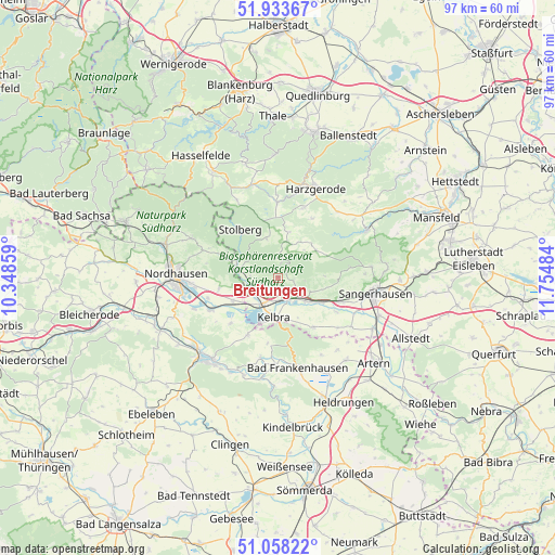
Breitungen GPS coordinates[2]
51° 29' 52.98" North, 11° 3' 6.156" East
| Map corner | latitude | longitude |
|---|---|---|
| Upper-left | 51.93367°, | 10.34859° |
| Center: | 51.49805°, | 11.05171° |
| Lower-right: | 51.05822°, | 11.75484° |
| Map W x H: | 97.3×97.3 km | = 60.5×60.5mi |
| max Lat: | 55.01917° ⇑33.8% North |
| Breitungen: | 51.49805° |
| min Lat: | ⇓66.2% South 47.40724° |
| min Long | Breitungen | max Long |
| 5.92978° | 11.05171° | 14.98853° |
| W 67.7%⇐ | ⇒32.3% E |
Elevation
Elevation of Breitungen is 269 m = 883 ft, and this is 19.9 m = 65 ft above average elevation for this country.
| Max E: |
1256 m = 4121 ft | 43.5% |
| Breitungen | 269 m 883 ft | |
| Avg. | 249.1 m = 817 ft | |
Min E: |
-5 m = -16 ft | 56.5% |
See also: Germany elevation on elevation.city.
Geographical zone
Breitungen is located in North temperate zone (between Tropic of Cancer and the Arctic Circle). Distance of this North polar circle is 1675.1 km =1040.9 mi to North.| Distance of | km | miles | from Breitungen |
|---|---|---|---|
| North Pole | 4281 | 2660.1 | to North |
| Arctic Circle | 1675.1 | 1040.9 | to North |
| Tropic Cancer | 3120.1 | 1938.7 | to South |
| Equator | 5726 | 3558 | to South |


Nearby cities:
15 places around Breitungen: (largest is in red/bold)
• Badra
11.5 km =7.1 mi,  207°
207°
• Bennungen
6.2 km =3.9 mi,  131°
131°
• Berga
5.6 km =3.5 mi, 213°
• Görsbach
8.9 km =5.5 mi,  243°
243°
• Hayn
8.2 km =5.1 mi,  13°
13°
• Kelbra
7 km =4.3 mi,  185°
185°
• Rottleberode
7.6 km =4.7 mi,  285°
285°
• Roßla
4.2 km =2.6 mi,  156°
156°
• Schwenda
7.2 km =4.5 mi,  343°
343°
• Steinthaleben
11.6 km =7.2 mi, 189°
• Stolberg
10.8 km =6.7 mi,  321°
321°
• Tilleda
10.6 km =6.6 mi,  144°
144°
• Uftrungen
4.9 km =3 mi,  270°
270°
• Urbach
10.6 km =6.6 mi,  259°
259°
• Wallhausen
11.5 km =7.1 mi,  110°
110°
Sources, notices
• [Note1] Compared only with cities in Germany existing in our database
• [Src1] Map data: © OpenStreetMap contributors (CC-BY-SA)
• [Src2] Other city data from geonames.org with taken over terms of usage.
• [Src3] Geographical zone / Annual Mean Temperature by Robert A. Rohde @ Wikipedia
