Rieden geodata
Rieden (Bavaria) is a populated place; located in Germany in Europe/Berlin (GMT+2) time zone. With population of 2,983 people, there are 4019 cities with bigger population in this country. Compared to other cities in Germany, 78.3% of cities are located further ↑North; 81% of cities are located further ←West and 70.9% of cities have lower elevation than Rieden. Note1
Administrative division(s):
- Level 1: Bavaria
- Level 2: Upper Palatinate
- Level 3: Landkreis Amberg-Sulzbach
- Level 4: Rieden, Markt


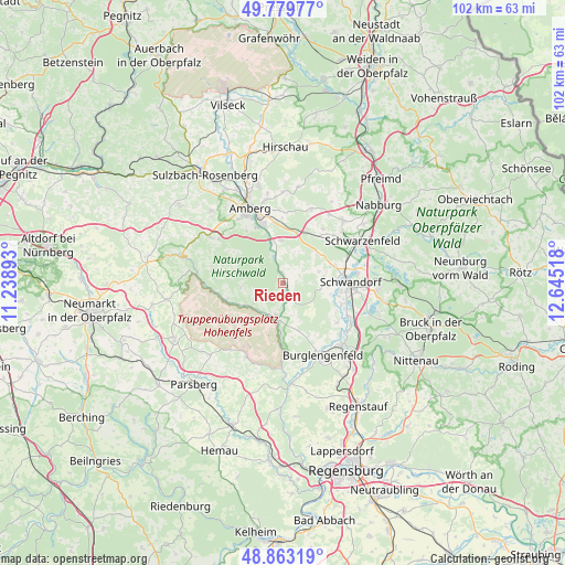
Rieden GPS coordinates[2]
49° 19' 24.996" North, 11° 56' 31.38" East
| Map corner | latitude | longitude |
|---|---|---|
| Upper-left | 49.77977°, | 11.23893° |
| Center: | 49.32361°, | 11.94205° |
| Lower-right: | 48.86319°, | 12.64518° |
| Map W x H: | 101.9×101.9 km | = 63.3×63.3mi |
| max Lat: | 55.01917° ⇑78.3% North |
| Rieden: | 49.32361° |
| min Lat: | ⇓21.7% South 47.40724° |
| min Long | Rieden | max Long |
| 5.92978° | 11.94205° | 14.98853° |
| W 81%⇐ | ⇒19% E |
Elevation
Elevation of Rieden is 365 m = 1198 ft, and this is 115.9 m = 380 ft above average elevation for this country.
| Max E: |
1256 m = 4121 ft | 29.1% |
| Rieden | 365 m 1198 ft | |
| Avg. | 249.1 m = 817 ft | |
Min E: |
-5 m = -16 ft | 70.9% |
See also: Germany elevation on elevation.city.
Geographical zone
Rieden is located in North temperate zone (between Tropic of Cancer and the Arctic Circle). Distance of this North polar circle is 1916.9 km =1191.1 mi to North.| Distance of | km | miles | from Rieden |
|---|---|---|---|
| North Pole | 4522.8 | 2810.3 | to North |
| Arctic Circle | 1916.9 | 1191.1 | to North |
| Tropic Cancer | 2878.4 | 1788.6 | to South |
| Equator | 5484.3 | 3407.8 | to South |


Nearby cities:
15 places around Rieden: (largest is in red/bold)
• Amberg
14.5 km =9 mi,  336°
336°
• Breitenbrunn
7.2 km =4.5 mi,  51°
51°
• Burglengenfeld
15.3 km =9.5 mi,  150°
150°
• Ebermannsdorf
7.8 km =4.8 mi,  356°
356°
• Ensdorf
1.9 km =1.2 mi,  346°
346°
• Hohenburg
10.8 km =6.7 mi,  252°
252°
• Hohenfels
14.9 km =9.3 mi,  207°
207°
• Kümmersbruck
11.3 km =7 mi, 339°
• Schmidgaden
15.5 km =9.6 mi,  44°
44°
• Schmidmühlen
6.2 km =3.9 mi,  191°
191°
• Schwandorf in Bayern
12.2 km =7.6 mi,  89°
89°
• Schwarzenfeld
15.7 km =9.8 mi,  62°
62°
• Stulln
17.3 km =10.7 mi, 53°
• Teublitz
15.4 km =9.6 mi,  136°
136°
• Ursensollen
16.1 km =10 mi,  302°
302°
Sources, notices
• [Note1] Compared only with cities in Germany existing in our database
• [Src1] Map data: © OpenStreetMap contributors (CC-BY-SA)
• [Src2] Other city data from geonames.org with taken over terms of usage.
• [Src3] Geographical zone / Annual Mean Temperature by Robert A. Rohde @ Wikipedia
