Ensdorf geodata
Ensdorf (Bavaria) is a seat of a fourth-order administrative division; located in Germany in Europe/Berlin (GMT+2) time zone. With population of 2,275 people, there are 4710 cities with bigger population in this country. Compared to other cities in Germany, 78.1% of cities are located further ↑North; 80.9% of cities are located further ←West and 71.8% of cities have lower elevation than Ensdorf. Note1
Administrative division(s):
- Level 1: Bavaria
- Level 2: Upper Palatinate
- Level 3: Landkreis Amberg-Sulzbach
- Level 4: Ensdorf


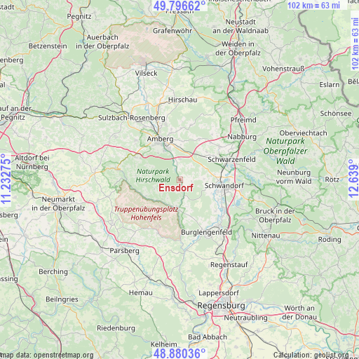
Ensdorf GPS coordinates[2]
49° 20' 26.232" North, 11° 56' 9.132" East
| Map corner | latitude | longitude |
|---|---|---|
| Upper-left | 49.79662°, | 11.23275° |
| Center: | 49.34062°, | 11.93587° |
| Lower-right: | 48.88036°, | 12.639° |
| Map W x H: | 101.9×101.9 km | = 63.3×63.3mi |
| max Lat: | 55.01917° ⇑78.1% North |
| Ensdorf: | 49.34062° |
| min Lat: | ⇓21.9% South 47.40724° |
| min Long | Ensdorf | max Long |
| 5.92978° | 11.93587° | 14.98853° |
| W 80.9%⇐ | ⇒19.1% E |
Elevation
Elevation of Ensdorf is 373 m = 1224 ft, and this is 123.9 m = 406 ft above average elevation for this country.
| Max E: |
1256 m = 4121 ft | 28.2% |
| Ensdorf | 373 m 1224 ft | |
| Avg. | 249.1 m = 817 ft | |
Min E: |
-5 m = -16 ft | 71.8% |
See also: Germany elevation on elevation.city.
Geographical zone
Ensdorf is located in North temperate zone (between Tropic of Cancer and the Arctic Circle). Distance of this North polar circle is 1915 km =1189.9 mi to North.| Distance of | km | miles | from Ensdorf |
|---|---|---|---|
| North Pole | 4520.9 | 2809.2 | to North |
| Arctic Circle | 1915 | 1189.9 | to North |
| Tropic Cancer | 2880.2 | 1789.7 | to South |
| Equator | 5486.2 | 3409 | to South |


Nearby cities:
15 places around Ensdorf: (largest is in red/bold)
• Amberg
12.5 km =7.8 mi,  335°
335°
• Ammerthal
16.8 km =10.4 mi,  311°
311°
• Breitenbrunn
6.6 km =4.1 mi,  67°
67°
• Ebermannsdorf
5.9 km =3.7 mi,  359°
359°
• Freudenberg
16.2 km =10.1 mi,  12°
12°
• Hohenburg
11.1 km =6.9 mi,  242°
242°
• Hohenfels
16.5 km =10.3 mi,  202°
202°
• Kümmersbruck
9.4 km =5.8 mi, 338°
• Rieden
1.9 km =1.2 mi,  166°
166°
• Schmidgaden
14.6 km =9.1 mi,  50°
50°
• Schmidmühlen
8 km =5 mi,  186°
186°
• Schwandorf in Bayern
12.7 km =7.9 mi,  97°
97°
• Schwarzenfeld
15.3 km =9.5 mi, 70°
• Stulln
16.6 km =10.3 mi,  59°
59°
• Ursensollen
14.8 km =9.2 mi,  297°
297°
Sources, notices
• [Note1] Compared only with cities in Germany existing in our database
• [Src1] Map data: © OpenStreetMap contributors (CC-BY-SA)
• [Src2] Other city data from geonames.org with taken over terms of usage.
• [Src3] Geographical zone / Annual Mean Temperature by Robert A. Rohde @ Wikipedia
