Schortens geodata
Schortens (Lower Saxony) is a seat of a fourth-order administrative division; located in Germany in Europe/Berlin (GMT+2) time zone. With population of 21,357 people, there are 712 cities with bigger population in this country. Compared to other cities in Germany, 85.9% of cities are located further ↓South; 78.1% of cities are located further →East and 96.2% of cities have higher elevation than Schortens. Note1


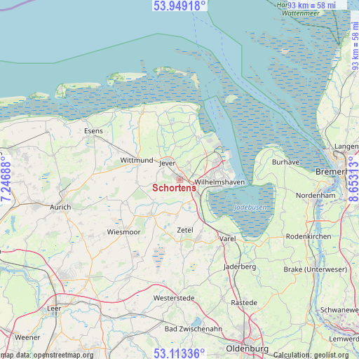
Schortens GPS coordinates[2]
53° 31' 59.988" North, 7° 57' 0" East
| Map corner | latitude | longitude |
|---|---|---|
| Upper-left | 53.94918°, | 7.24688° |
| Center: | 53.53333°, | 7.95° |
| Lower-right: | 53.11336°, | 8.65313° |
| Map W x H: | 92.9×92.9 km | = 57.7×57.7mi |
| max Lat: | 55.01917° ⇑14.1% North |
| Schortens: | 53.53333° |
| min Lat: | ⇓85.9% South 47.40724° |
| min Long | Schortens | max Long |
| 5.92978° | 7.95° | 14.98853° |
| W 21.9%⇐ | ⇒78.1% E |
Elevation
Elevation of Schortens is 6 m = 20 ft, and this is 243.1 m = 798 ft below average elevation for this country.
| Max E: |
1256 m = 4121 ft | 96.2% |
| Avg. | 249.1 m = 817 ft | |
| Schortens | 6 m = 20 ft | |
Min E: |
-5 m = -16 ft | 3.8% |
See also: Germany elevation on elevation.city.
Geographical zone
Schortens is located in North temperate zone (between Tropic of Cancer and the Arctic Circle). Distance of this North polar circle is 1448.8 km =900.2 mi to North.| Distance of | km | miles | from Schortens |
|---|---|---|---|
| North Pole | 4054.7 | 2519.5 | to North |
| Arctic Circle | 1448.8 | 900.2 | to North |
| Tropic Cancer | 3346.4 | 2079.4 | to South |
| Equator | 5952.3 | 3698.6 | to South |


Nearby cities:
15 places around Schortens: (largest is in red/bold)
• Bockhorn
15.5 km =9.6 mi,  163°
163°
• Carolinensiel
20.1 km =12.5 mi,  330°
330°
• Dunum
21.2 km =13.2 mi,  290°
290°
• Fedderwarden
6.9 km =4.3 mi,  63°
63°
• Friedeburg
12.1 km =7.5 mi,  219°
219°
• Jever
5.6 km =3.5 mi,  322°
322°
• Sande
5.3 km =3.3 mi,  126°
126°
• Schillig
19.5 km =12.1 mi,  14°
14°
• Sillenstede
5.1 km =3.2 mi,  26°
26°
• Varel
19.5 km =12.1 mi,  140°
140°
• Werdum
20.6 km =12.8 mi,  312°
312°
• Wiesmoor
19.3 km =12 mi,  227°
227°
• Wilhelmshaven
10.7 km =6.6 mi,  91°
91°
• Wittmund
12.3 km =7.6 mi, 293°
• Zetel
13.2 km =8.2 mi,  170°
170°
Sources, notices
• [Note1] Compared only with cities in Germany existing in our database
• [Src1] Map data: © OpenStreetMap contributors (CC-BY-SA)
• [Src2] Other city data from geonames.org with taken over terms of usage.
• [Src3] Geographical zone / Annual Mean Temperature by Robert A. Rohde @ Wikipedia
