Schiffweiler geodata
Schiffweiler (Saarland) is a seat of a fourth-order administrative division; located in Germany in Europe/Berlin (GMT+2) time zone. With population of 15,780 people, there are 1015 cities with bigger population in this country. Compared to other cities in Germany, 77.7% of cities are located further ↑North; 92.1% of cities are located further →East and 60.9% of cities have lower elevation than Schiffweiler. Note1


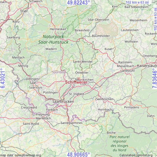
Schiffweiler GPS coordinates[2]
49° 22' 0.012" North, 7° 7' 59.988" East
| Map corner | latitude | longitude |
|---|---|---|
| Upper-left | 49.82243°, | 6.43021° |
| Center: | 49.36667°, | 7.13333° |
| Lower-right: | 48.90665°, | 7.83646° |
| Map W x H: | 101.8×101.8 km | = 63.3×63.3mi |
| max Lat: | 55.01917° ⇑77.7% North |
| Schiffweiler: | 49.36667° |
| min Lat: | ⇓22.3% South 47.40724° |
| min Long | Schiffweiler | max Long |
| 5.92978° | 7.13333° | 14.98853° |
| W 7.9%⇐ | ⇒92.1% E |
Elevation
Elevation of Schiffweiler is 295 m = 968 ft, and this is 45.9 m = 151 ft above average elevation for this country.
| Max E: |
1256 m = 4121 ft | 39.1% |
| Schiffweiler | 295 m 968 ft | |
| Avg. | 249.1 m = 817 ft | |
Min E: |
-5 m = -16 ft | 60.9% |
See also: Germany elevation on elevation.city.
Geographical zone
Schiffweiler is located in North temperate zone (between Tropic of Cancer and the Arctic Circle). Distance of this North polar circle is 1912.1 km =1188.1 mi to North.| Distance of | km | miles | from Schiffweiler |
|---|---|---|---|
| North Pole | 4518 | 2807.4 | to North |
| Arctic Circle | 1912.1 | 1188.1 | to North |
| Tropic Cancer | 2883.1 | 1791.5 | to South |
| Equator | 5489.1 | 3410.8 | to South |


Nearby cities:
15 places around Schiffweiler: (largest is in red/bold)
• Bexbach
9.1 km =5.7 mi,  104°
104°
• Friedrichsthal
5.1 km =3.2 mi,  211°
211°
• Hangard
5.9 km =3.7 mi,  72°
72°
• Illingen
6.3 km =3.9 mi,  277°
277°
• Kirkel
11.8 km =7.3 mi,  141°
141°
• Mainzweiler
5.7 km =3.5 mi,  348°
348°
• Marpingen
11 km =6.8 mi,  330°
330°
• Merchweiler
6.3 km =3.9 mi,  252°
252°
• Neunkirchen
4.2 km =2.6 mi,  125°
125°
• Ottweiler
4.5 km =2.8 mi,  30°
30°
• Quierschied
8.2 km =5.1 mi,  227°
227°
• Sankt Ingbert
10 km =6.2 mi,  186°
186°
• Sankt Wendel
11.4 km =7.1 mi,  12°
12°
• Spiesen-Elversberg
5.6 km =3.5 mi,  180°
180°
• Sulzbach
9.4 km =5.8 mi,  216°
216°
Sources, notices
• [Note1] Compared only with cities in Germany existing in our database
• [Src1] Map data: © OpenStreetMap contributors (CC-BY-SA)
• [Src2] Other city data from geonames.org with taken over terms of usage.
• [Src3] Geographical zone / Annual Mean Temperature by Robert A. Rohde @ Wikipedia
