Scheibenberg geodata
Scheibenberg (Saxony) is a populated place; located in Germany in Europe/Berlin (GMT+2) time zone. With population of 2,358 people, there are 4594 cities with bigger population in this country. Compared to other cities in Germany, 52% of cities are located further ↑North; 91.6% of cities are located further ←West and 97.5% of cities have lower elevation than Scheibenberg. Note1


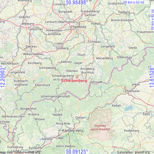
Scheibenberg GPS coordinates[2]
50° 32' 24.828" North, 12° 54' 43.74" East
| Map corner | latitude | longitude |
|---|---|---|
| Upper-left | 50.98498°, | 12.20903° |
| Center: | 50.54023°, | 12.91215° |
| Lower-right: | 50.09125°, | 13.61528° |
| Map W x H: | 99.4×99.4 km | = 61.8×61.8mi |
| max Lat: | 55.01917° ⇑52% North |
| Scheibenberg: | 50.54023° |
| min Lat: | ⇓48% South 47.40724° |
| min Long | Scheibenberg | max Long |
| 5.92978° | 12.91215° | 14.98853° |
| W 91.6%⇐ | ⇒8.4% E |
Elevation
Elevation of Scheibenberg is 683 m = 2241 ft, and this is 433.9 m = 1424 ft above average elevation for this country.
| Max E: |
1256 m = 4121 ft | 2.5% |
| Scheibenberg | 683 m 2241 ft | |
| Avg. | 249.1 m = 817 ft | |
Min E: |
-5 m = -16 ft | 97.5% |
See also: Germany elevation on elevation.city.
Geographical zone
Scheibenberg is located in North temperate zone (between Tropic of Cancer and the Arctic Circle). Distance of this North polar circle is 1781.6 km =1107 mi to North.| Distance of | km | miles | from Scheibenberg |
|---|---|---|---|
| North Pole | 4387.5 | 2726.3 | to North |
| Arctic Circle | 1781.6 | 1107 | to North |
| Tropic Cancer | 3013.6 | 1872.6 | to South |
| Equator | 5619.5 | 3491.8 | to South |


Nearby cities:
15 places around Scheibenberg: (largest is in red/bold)
• Annaberg-Buchholz
8 km =5 mi,  56°
56°
• Beierfeld
9 km =5.6 mi,  287°
287°
• Bärenstein
9.7 km =6 mi,  117°
117°
• Crottendorf
3.7 km =2.3 mi,  134°
134°
• Elterlein
5.1 km =3.2 mi,  322°
322°
• Geyer
9.6 km =6 mi,  3°
3°
• Grünhain
8.7 km =5.4 mi,  300°
300°
• Königswalde
9.8 km =6.1 mi,  83°
83°
• Markersbach
3.6 km =2.2 mi,  261°
261°
• Pöhla
7.3 km =4.5 mi,  244°
244°
• Raschau
5.7 km =3.5 mi, 259°
• Schlettau
3.5 km =2.2 mi,  54°
54°
• Schwarzenberg
9 km =5.6 mi,  268°
268°
• Tannenberg
7.7 km =4.8 mi,  13°
13°
• Wiesa
10.7 km =6.6 mi,  42°
42°
Sources, notices
• [Note1] Compared only with cities in Germany existing in our database
• [Src1] Map data: © OpenStreetMap contributors (CC-BY-SA)
• [Src2] Other city data from geonames.org with taken over terms of usage.
• [Src3] Geographical zone / Annual Mean Temperature by Robert A. Rohde @ Wikipedia
