Rothenschirmbach geodata
Rothenschirmbach (Saxony-Anhalt) is a populated place; located in Germany in Europe/Berlin (GMT+2) time zone. With population of 659 people, there are 8516 cities with bigger population in this country. Compared to other cities in Germany, 65.6% of cities are located further ↓South; 75% of cities are located further ←West and 55.1% of cities have higher elevation than Rothenschirmbach. Note1
Administrative division(s):
- Level 1: Saxony-Anhalt
- Level 3: Mansfeld-Südharz
- Level 4: Eisleben, Lutherstadt


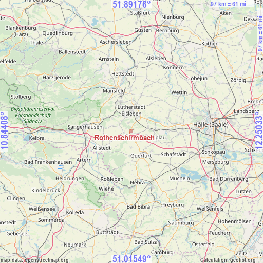
Rothenschirmbach GPS coordinates[2]
51° 27' 20.628" North, 11° 32' 49.92" East
| Map corner | latitude | longitude |
|---|---|---|
| Upper-left | 51.89176°, | 10.84408° |
| Center: | 51.45573°, | 11.5472° |
| Lower-right: | 51.01549°, | 12.25033° |
| Map W x H: | 97.4×97.4 km | = 60.5×60.5mi |
| max Lat: | 55.01917° ⇑34.4% North |
| Rothenschirmbach: | 51.45573° |
| min Lat: | ⇓65.6% South 47.40724° |
| min Long | Rothenschirmbac | max Long |
| 5.92978° | 11.5472° | 14.98853° |
| W 75%⇐ | ⇒25% E |
Elevation
Elevation of Rothenschirmbach is 187 m = 614 ft, and this is 62.1 m = 204 ft below average elevation for this country.
| Max E: |
1256 m = 4121 ft | 55.1% |
| Avg. | 249.1 m = 817 ft | |
| Rothenschirmbach | 187 m = 614 ft | |
Min E: |
-5 m = -16 ft | 44.9% |
See also: Germany elevation on elevation.city.
Geographical zone
Rothenschirmbach is located in North temperate zone (between Tropic of Cancer and the Arctic Circle). Distance of this North polar circle is 1679.8 km =1043.8 mi to North.| Distance of | km | miles | from Rothenschirmbach |
|---|---|---|---|
| North Pole | 4285.7 | 2663 | to North |
| Arctic Circle | 1679.8 | 1043.8 | to North |
| Tropic Cancer | 3115.4 | 1935.8 | to South |
| Equator | 5721.3 | 3555 | to South |


Nearby cities:
15 places around Rothenschirmbach: (largest is in red/bold)
• Alberstedt
5.5 km =3.4 mi,  99°
99°
• Bischofrode
3.6 km =2.2 mi,  342°
342°
• Bornstedt
5.4 km =3.4 mi,  304°
304°
• Eisleben Lutherstadt
8 km =5 mi,  0°
0°
• Erdeborn
6.5 km =4 mi,  70°
70°
• Farnstädt
2.8 km =1.7 mi,  151°
151°
• Holdenstedt
7.3 km =4.5 mi,  287°
287°
• Lüttchendorf
7.5 km =4.7 mi,  47°
47°
• Mittelhausen
6.4 km =4 mi,  247°
247°
• Osterhausen
3 km =1.9 mi,  266°
266°
• Querfurt
9.1 km =5.7 mi,  155°
155°
• Schraplau
8.6 km =5.3 mi, 103°
• Wimmelburg
7.7 km =4.8 mi, 338°
• Wolferode
6.1 km =3.8 mi, 337°
• Wolferstedt
8.5 km =5.3 mi, 246°
Sources, notices
• [Note1] Compared only with cities in Germany existing in our database
• [Src1] Map data: © OpenStreetMap contributors (CC-BY-SA)
• [Src2] Other city data from geonames.org with taken over terms of usage.
• [Src3] Geographical zone / Annual Mean Temperature by Robert A. Rohde @ Wikipedia
