Wolferode geodata
Wolferode (Saxony-Anhalt) is a populated place; located in Germany in Europe/Berlin (GMT+2) time zone. With population of 1,292 people, there are 6332 cities with bigger population in this country. Compared to other cities in Germany, 66.4% of cities are located further ↓South; 74.5% of cities are located further ←West and 52.6% of cities have higher elevation than Wolferode. Note1
Administrative division(s):
- Level 1: Saxony-Anhalt
- Level 3: Mansfeld-Südharz
- Level 4: Eisleben, Lutherstadt


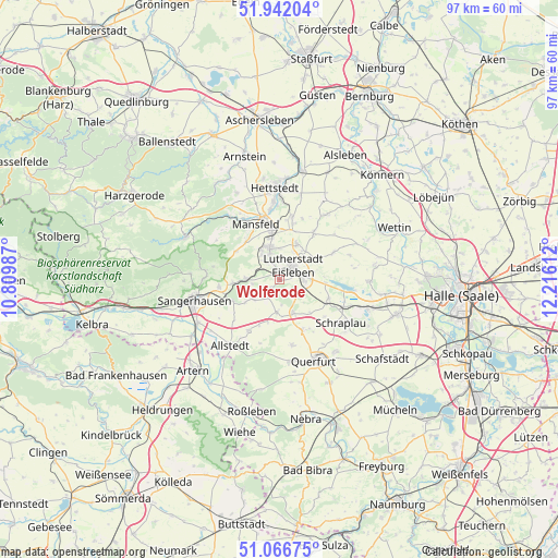
Wolferode GPS coordinates[2]
51° 30' 23.4" North, 11° 30' 46.764" East
| Map corner | latitude | longitude |
|---|---|---|
| Upper-left | 51.94204°, | 10.80987° |
| Center: | 51.5065°, | 11.51299° |
| Lower-right: | 51.06675°, | 12.21612° |
| Map W x H: | 97.3×97.3 km | = 60.5×60.5mi |
| max Lat: | 55.01917° ⇑33.6% North |
| Wolferode: | 51.5065° |
| min Lat: | ⇓66.4% South 47.40724° |
| min Long | Wolferode | max Long |
| 5.92978° | 11.51299° | 14.98853° |
| W 74.5%⇐ | ⇒25.5% E |
Elevation
Elevation of Wolferode is 207 m = 679 ft, and this is 42.1 m = 138 ft below average elevation for this country.
| Max E: |
1256 m = 4121 ft | 52.6% |
| Avg. | 249.1 m = 817 ft | |
| Wolferode | 207 m = 679 ft | |
Min E: |
-5 m = -16 ft | 47.4% |
See also: Germany elevation on elevation.city.
Geographical zone
Wolferode is located in North temperate zone (between Tropic of Cancer and the Arctic Circle). Distance of this North polar circle is 1674.2 km =1040.3 mi to North.| Distance of | km | miles | from Wolferode |
|---|---|---|---|
| North Pole | 4280.1 | 2659.5 | to North |
| Arctic Circle | 1674.2 | 1040.3 | to North |
| Tropic Cancer | 3121.1 | 1939.4 | to South |
| Equator | 5727 | 3558.6 | to South |


Nearby cities:
15 places around Wolferode: (largest is in red/bold)
• Ahlsdorf
5.4 km =3.4 mi,  323°
323°
• Benndorf
7.2 km =4.5 mi,  348°
348°
• Bischofrode
2.6 km =1.6 mi,  149°
149°
• Blankenheim
5.8 km =3.6 mi,  270°
270°
• Bornstedt
3.3 km =2.1 mi,  218°
218°
• Eisleben Lutherstadt
3.4 km =2.1 mi,  46°
46°
• Emseloh
8.4 km =5.2 mi, 266°
• Helbra
4.9 km =3 mi, 349°
• Hergisdorf
3.6 km =2.2 mi,  325°
325°
• Holdenstedt
5.8 km =3.6 mi,  233°
233°
• Lüttchendorf
7.9 km =4.9 mi,  93°
93°
• Osterhausen
5.8 km =3.6 mi,  185°
185°
• Rothenschirmbach
6.1 km =3.8 mi,  157°
157°
• Volkstedt
6.9 km =4.3 mi,  25°
25°
• Wimmelburg
1.6 km =1 mi, 345°
Sources, notices
• [Note1] Compared only with cities in Germany existing in our database
• [Src1] Map data: © OpenStreetMap contributors (CC-BY-SA)
• [Src2] Other city data from geonames.org with taken over terms of usage.
• [Src3] Geographical zone / Annual Mean Temperature by Robert A. Rohde @ Wikipedia
