Lüttchendorf geodata
Lüttchendorf (Saxony-Anhalt) is a populated place; located in Germany in Europe/Berlin (GMT+2) time zone. With population of 658 people, there are 8521 cities with bigger population in this country. Compared to other cities in Germany, 66.4% of cities are located further ↓South; 76.1% of cities are located further ←West and 68.8% of cities have higher elevation than Lüttchendorf. Note1
Administrative division(s):
- Level 1: Saxony-Anhalt
- Level 3: Mansfeld-Südharz
- Level 4: Seegebiet Mansfelder Land


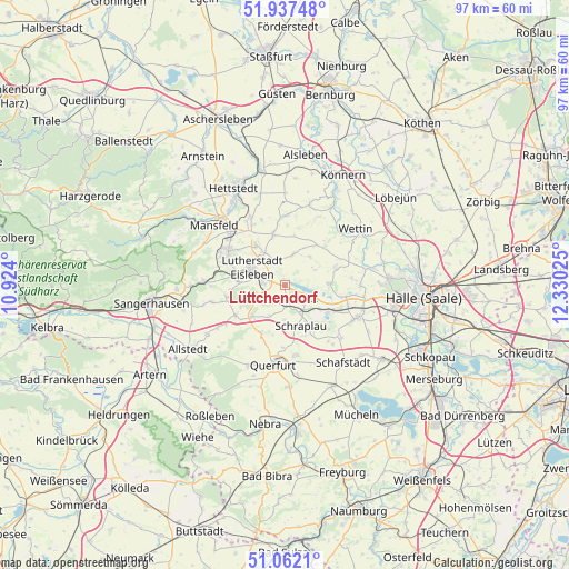
Lüttchendorf GPS coordinates[2]
51° 30' 6.804" North, 11° 37' 37.632" East
| Map corner | latitude | longitude |
|---|---|---|
| Upper-left | 51.93748°, | 10.924° |
| Center: | 51.50189°, | 11.62712° |
| Lower-right: | 51.0621°, | 12.33025° |
| Map W x H: | 97.3×97.3 km | = 60.5×60.5mi |
| max Lat: | 55.01917° ⇑33.6% North |
| Lüttchendorf: | 51.50189° |
| min Lat: | ⇓66.4% South 47.40724° |
| min Long | Lüttchendorf | max Long |
| 5.92978° | 11.62712° | 14.98853° |
| W 76.1%⇐ | ⇒23.9% E |
Elevation
Elevation of Lüttchendorf is 98 m = 322 ft, and this is 151.1 m = 496 ft below average elevation for this country.
| Max E: |
1256 m = 4121 ft | 68.8% |
| Avg. | 249.1 m = 817 ft | |
| Lüttchendorf | 98 m = 322 ft | |
Min E: |
-5 m = -16 ft | 31.2% |
See also: Germany elevation on elevation.city.
Geographical zone
Lüttchendorf is located in North temperate zone (between Tropic of Cancer and the Arctic Circle). Distance of this North polar circle is 1674.7 km =1040.6 mi to North.| Distance of | km | miles | from Lüttchendorf |
|---|---|---|---|
| North Pole | 4280.6 | 2659.8 | to North |
| Arctic Circle | 1674.7 | 1040.6 | to North |
| Tropic Cancer | 3120.6 | 1939.1 | to South |
| Equator | 5726.5 | 3558.3 | to South |


Nearby cities:
15 places around Lüttchendorf: (largest is in red/bold)
• Alberstedt
6 km =3.7 mi,  181°
181°
• Amsdorf
8.1 km =5 mi,  120°
120°
• Bischofrode
6.8 km =4.2 mi,  255°
255°
• Eisleben Lutherstadt
6.2 km =3.9 mi,  297°
297°
• Erdeborn
3 km =1.9 mi,  169°
169°
• Hedersleben
5.5 km =3.4 mi,  16°
16°
• Höhnstedt
7.7 km =4.8 mi,  89°
89°
• Rothenschirmbach
7.5 km =4.7 mi,  227°
227°
• Röblingen am See
6.1 km =3.8 mi,  141°
141°
• Schraplau
7.7 km =4.8 mi,  158°
158°
• Seeburg
5.4 km =3.4 mi,  103°
103°
• Stedten
8 km =5 mi,  145°
145°
• Volkstedt
8.3 km =5.2 mi,  324°
324°
• Wimmelburg
8.6 km =5.3 mi,  284°
284°
• Wolferode
7.9 km =4.9 mi,  273°
273°
Sources, notices
• [Note1] Compared only with cities in Germany existing in our database
• [Src1] Map data: © OpenStreetMap contributors (CC-BY-SA)
• [Src2] Other city data from geonames.org with taken over terms of usage.
• [Src3] Geographical zone / Annual Mean Temperature by Robert A. Rohde @ Wikipedia
