Erdeborn geodata
Erdeborn (Saxony-Anhalt) is a populated place; located in Germany in Europe/Berlin (GMT+2) time zone. With population of 1,117 people, there are 6799 cities with bigger population in this country. Compared to other cities in Germany, 65.9% of cities are located further ↓South; 76.3% of cities are located further ←West and 67.6% of cities have higher elevation than Erdeborn. Note1
Administrative division(s):
- Level 1: Saxony-Anhalt
- Level 3: Mansfeld-Südharz
- Level 4: Seegebiet Mansfelder Land


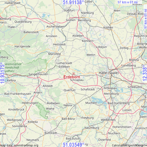
Erdeborn GPS coordinates[2]
51° 28' 31.944" North, 11° 38' 5.532" East
| Map corner | latitude | longitude |
|---|---|---|
| Upper-left | 51.91138°, | 10.93175° |
| Center: | 51.47554°, | 11.63487° |
| Lower-right: | 51.03549°, | 12.338° |
| Map W x H: | 97.4×97.4 km | = 60.5×60.5mi |
| max Lat: | 55.01917° ⇑34.1% North |
| Erdeborn: | 51.47554° |
| min Lat: | ⇓65.9% South 47.40724° |
| min Long | Erdeborn | max Long |
| 5.92978° | 11.63487° | 14.98853° |
| W 76.3%⇐ | ⇒23.7% E |
Elevation
Elevation of Erdeborn is 104 m = 341 ft, and this is 145.1 m = 476 ft below average elevation for this country.
| Max E: |
1256 m = 4121 ft | 67.6% |
| Avg. | 249.1 m = 817 ft | |
| Erdeborn | 104 m = 341 ft | |
Min E: |
-5 m = -16 ft | 32.4% |
See also: Germany elevation on elevation.city.
Geographical zone
Erdeborn is located in North temperate zone (between Tropic of Cancer and the Arctic Circle). Distance of this North polar circle is 1677.6 km =1042.4 mi to North.| Distance of | km | miles | from Erdeborn |
|---|---|---|---|
| North Pole | 4283.5 | 2661.6 | to North |
| Arctic Circle | 1677.6 | 1042.4 | to North |
| Tropic Cancer | 3117.6 | 1937.2 | to South |
| Equator | 5723.5 | 3556.4 | to South |


Nearby cities:
15 places around Erdeborn: (largest is in red/bold)
• Alberstedt
3.2 km =2 mi,  192°
192°
• Amsdorf
6.5 km =4 mi,  100°
100°
• Bischofrode
7.3 km =4.5 mi,  279°
279°
• Eisleben Lutherstadt
8.3 km =5.2 mi,  313°
313°
• Esperstedt
6.5 km =4 mi,  152°
152°
• Farnstädt
6.7 km =4.2 mi,  225°
225°
• Hedersleben
8.2 km =5.1 mi,  7°
7°
• Höhnstedt
7.8 km =4.8 mi,  67°
67°
• Lüttchendorf
3 km =1.9 mi,  349°
349°
• Rothenschirmbach
6.5 km =4 mi,  250°
250°
• Röblingen am See
3.7 km =2.3 mi,  118°
118°
• Schraplau
4.8 km =3 mi, 151°
• Seeburg
5 km =3.1 mi, 70°
• Stedten
5.4 km =3.4 mi,  131°
131°
• Wansleben
8.2 km =5.1 mi, 101°
Sources, notices
• [Note1] Compared only with cities in Germany existing in our database
• [Src1] Map data: © OpenStreetMap contributors (CC-BY-SA)
• [Src2] Other city data from geonames.org with taken over terms of usage.
• [Src3] Geographical zone / Annual Mean Temperature by Robert A. Rohde @ Wikipedia
