Reisbach geodata
Reisbach (Bavaria) is a populated place; located in Germany in Europe/Berlin (GMT+2) time zone. With population of 7,610 people, there are 2039 cities with bigger population in this country. Compared to other cities in Germany, 88.2% of cities are located further ↑North; 89.1% of cities are located further ←West and 76.1% of cities have lower elevation than Reisbach. Note1
Administrative division(s):
- Level 1: Bavaria
- Level 2: Lower Bavaria
- Level 3: Landkreis Dingolfing-Landau
- Level 4: Reisbach, Markt


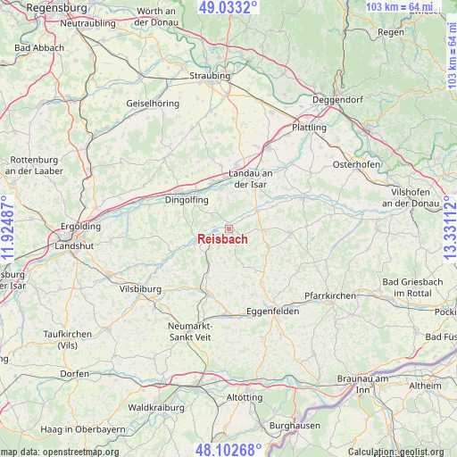
Reisbach GPS coordinates[2]
48° 34' 12.288" North, 12° 37' 40.764" East
| Map corner | latitude | longitude |
|---|---|---|
| Upper-left | 49.0332°, | 11.92487° |
| Center: | 48.57008°, | 12.62799° |
| Lower-right: | 48.10268°, | 13.33112° |
| Map W x H: | 103.5×103.5 km | = 64.3×64.3mi |
| max Lat: | 55.01917° ⇑88.2% North |
| Reisbach: | 48.57008° |
| min Lat: | ⇓11.8% South 47.40724° |
| min Long | Reisbach | max Long |
| 5.92978° | 12.62799° | 14.98853° |
| W 89.1%⇐ | ⇒10.9% E |
Elevation
Elevation of Reisbach is 406 m = 1332 ft, and this is 156.9 m = 515 ft above average elevation for this country.
| Max E: |
1256 m = 4121 ft | 23.9% |
| Reisbach | 406 m 1332 ft | |
| Avg. | 249.1 m = 817 ft | |
Min E: |
-5 m = -16 ft | 76.1% |
See also: Germany elevation on elevation.city.
Geographical zone
Reisbach is located in North temperate zone (between Tropic of Cancer and the Arctic Circle). Distance of this North polar circle is 2000.7 km =1243.2 mi to North.| Distance of | km | miles | from Reisbach |
|---|---|---|---|
| North Pole | 4606.6 | 2862.4 | to North |
| Arctic Circle | 2000.7 | 1243.2 | to North |
| Tropic Cancer | 2794.6 | 1736.5 | to South |
| Equator | 5400.5 | 3355.7 | to South |


Nearby cities:
15 places around Reisbach: (largest is in red/bold)
• Aham
13.2 km =8.2 mi,  248°
248°
• Arnstorf
13.9 km =8.6 mi,  95°
95°
• Dingolfing
12.8 km =8 mi,  308°
308°
• Falkenberg
14.2 km =8.8 mi,  147°
147°
• Frontenhausen
7.6 km =4.7 mi, 249°
• Gottfrieding
10.1 km =6.3 mi,  317°
317°
• Landau an der Isar
12.4 km =7.7 mi,  22°
22°
• Loiching
15.2 km =9.4 mi,  289°
289°
• Malgersdorf
9.9 km =6.2 mi,  114°
114°
• Mamming
9.2 km =5.7 mi,  350°
350°
• Marklkofen
5 km =3.1 mi,  243°
243°
• Pilsting
14.7 km =9.1 mi,  6°
6°
• Rimbach
11.6 km =7.2 mi,  171°
171°
• Ruhstorf
5.3 km =3.3 mi,  129°
129°
• Simbach
8.2 km =5.1 mi,  93°
93°
Sources, notices
• [Note1] Compared only with cities in Germany existing in our database
• [Src1] Map data: © OpenStreetMap contributors (CC-BY-SA)
• [Src2] Other city data from geonames.org with taken over terms of usage.
• [Src3] Geographical zone / Annual Mean Temperature by Robert A. Rohde @ Wikipedia
