Ruhstorf geodata
Ruhstorf (Bavaria) is a populated place; located in Germany in Europe/Berlin (GMT+2) time zone. With population of 7,098 people, there are 2159 cities with bigger population in this country. Compared to other cities in Germany, 88.6% of cities are located further ↑North; 89.6% of cities are located further ←West and 81.7% of cities have lower elevation than Ruhstorf. Note1
Administrative division(s):
- Level 1: Bavaria
- Level 2: Lower Bavaria
- Level 3: Landkreis Dingolfing-Landau
- Level 4: Simbach, Markt


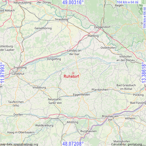
Ruhstorf GPS coordinates[2]
48° 32' 23.136" North, 12° 40' 58.98" East
| Map corner | latitude | longitude |
|---|---|---|
| Upper-left | 49.00316°, | 11.97993° |
| Center: | 48.53976°, | 12.68305° |
| Lower-right: | 48.07208°, | 13.38618° |
| Map W x H: | 103.5×103.5 km | = 64.3×64.3mi |
| max Lat: | 55.01917° ⇑88.6% North |
| Ruhstorf: | 48.53976° |
| min Lat: | ⇓11.4% South 47.40724° |
| min Long | Ruhstorf | max Long |
| 5.92978° | 12.68305° | 14.98853° |
| W 89.6%⇐ | ⇒10.4% E |
Elevation
Elevation of Ruhstorf is 444 m = 1457 ft, and this is 194.9 m = 639 ft above average elevation for this country.
| Max E: |
1256 m = 4121 ft | 18.3% |
| Ruhstorf | 444 m 1457 ft | |
| Avg. | 249.1 m = 817 ft | |
Min E: |
-5 m = -16 ft | 81.7% |
See also: Germany elevation on elevation.city.
Geographical zone
Ruhstorf is located in North temperate zone (between Tropic of Cancer and the Arctic Circle). Distance of this North polar circle is 2004.1 km =1245.3 mi to North.| Distance of | km | miles | from Ruhstorf |
|---|---|---|---|
| North Pole | 4609.9 | 2864.5 | to North |
| Arctic Circle | 2004.1 | 1245.3 | to North |
| Tropic Cancer | 2791.2 | 1734.4 | to South |
| Equator | 5397.1 | 3353.6 | to South |


Nearby cities:
15 places around Ruhstorf: (largest is in red/bold)
• Arnstorf
10.1 km =6.3 mi,  78°
78°
• Eggenfelden
15.9 km =9.9 mi,  159°
159°
• Eichendorf
16.4 km =10.2 mi,  50°
50°
• Falkenberg
9.4 km =5.8 mi, 158°
• Frontenhausen
11.2 km =7 mi,  273°
273°
• Gangkofen
14.4 km =8.9 mi,  217°
217°
• Gottfrieding
15.3 km =9.5 mi,  315°
315°
• Landau an der Isar
14.8 km =9.2 mi,  2°
2°
• Malgersdorf
5 km =3.1 mi,  98°
98°
• Mamming
13.6 km =8.5 mi,  336°
336°
• Marklkofen
8.6 km =5.3 mi,  277°
277°
• Reisbach
5.3 km =3.3 mi,  309°
309°
• Rimbach
8.5 km =5.3 mi,  196°
196°
• Schönau
13.8 km =8.6 mi,  117°
117°
• Simbach
5 km =3.1 mi, 54°
Sources, notices
• [Note1] Compared only with cities in Germany existing in our database
• [Src1] Map data: © OpenStreetMap contributors (CC-BY-SA)
• [Src2] Other city data from geonames.org with taken over terms of usage.
• [Src3] Geographical zone / Annual Mean Temperature by Robert A. Rohde @ Wikipedia
