Etzelwang geodata
Etzelwang (Bavaria) is a seat of a fourth-order administrative division; located in Germany in Europe/Berlin (GMT+2) time zone. With population of 1,562 people, there are 5759 cities with bigger population in this country. Compared to other cities in Germany, 75.2% of cities are located further ↑North; 75.6% of cities are located further ←West and 79.9% of cities have lower elevation than Etzelwang. Note1
Administrative division(s):
- Level 1: Bavaria
- Level 2: Upper Palatinate
- Level 3: Landkreis Amberg-Sulzbach
- Level 4: Etzelwang


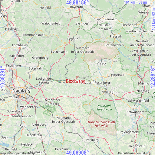
Etzelwang GPS coordinates[2]
49° 31' 39.36" North, 11° 35' 9.708" East
| Map corner | latitude | longitude |
|---|---|---|
| Upper-left | 49.98186°, | 10.88291° |
| Center: | 49.5276°, | 11.58603° |
| Lower-right: | 49.06908°, | 12.28916° |
| Map W x H: | 101.5×101.5 km | = 63.1×63.1mi |
| max Lat: | 55.01917° ⇑75.2% North |
| Etzelwang: | 49.5276° |
| min Lat: | ⇓24.8% South 47.40724° |
| min Long | Etzelwang | max Long |
| 5.92978° | 11.58603° | 14.98853° |
| W 75.6%⇐ | ⇒24.4% E |
Elevation
Elevation of Etzelwang is 432 m = 1417 ft, and this is 182.9 m = 600 ft above average elevation for this country.
| Max E: |
1256 m = 4121 ft | 20.1% |
| Etzelwang | 432 m 1417 ft | |
| Avg. | 249.1 m = 817 ft | |
Min E: |
-5 m = -16 ft | 79.9% |
See also: Germany elevation on elevation.city.
Geographical zone
Etzelwang is located in North temperate zone (between Tropic of Cancer and the Arctic Circle). Distance of this North polar circle is 1894.2 km =1177 mi to North.| Distance of | km | miles | from Etzelwang |
|---|---|---|---|
| North Pole | 4500.1 | 2796.2 | to North |
| Arctic Circle | 1894.2 | 1177 | to North |
| Tropic Cancer | 2901 | 1802.6 | to South |
| Equator | 5507 | 3421.9 | to South |


Nearby cities:
15 places around Etzelwang: (largest is in red/bold)
• Alfeld
10.8 km =6.7 mi,  193°
193°
• Edelsfeld
9.6 km =6 mi,  55°
55°
• Happurg
9.1 km =5.7 mi,  245°
245°
• Hartenstein
9.5 km =5.9 mi,  328°
328°
• Hersbruck
11.3 km =7 mi,  260°
260°
• Hirschbach
4.5 km =2.8 mi,  303°
303°
• Illschwang
11.1 km =6.9 mi,  140°
140°
• Kirchensittenbach
12.2 km =7.6 mi,  284°
284°
• Königstein
9.6 km =6 mi,  19°
19°
• Neuhaus an der Pegnitz
11.4 km =7.1 mi,  347°
347°
• Pommelsbrunn
6 km =3.7 mi,  244°
244°
• Sulzbach-Rosenberg
11.9 km =7.4 mi,  104°
104°
• Velden
11 km =6.8 mi, 330°
• Vorra
7.4 km =4.6 mi, 296°
• Weigendorf
3.5 km =2.2 mi,  200°
200°
Sources, notices
• [Note1] Compared only with cities in Germany existing in our database
• [Src1] Map data: © OpenStreetMap contributors (CC-BY-SA)
• [Src2] Other city data from geonames.org with taken over terms of usage.
• [Src3] Geographical zone / Annual Mean Temperature by Robert A. Rohde @ Wikipedia
