Painten geodata
Painten (Bavaria) is a populated place; located in Germany in Europe/Berlin (GMT+2) time zone. With population of 2,280 people, there are 4705 cities with bigger population in this country. Compared to other cities in Germany, 83.1% of cities are located further ↑North; 79.1% of cities are located further ←West and 89.4% of cities have lower elevation than Painten. Note1
Administrative division(s):
- Level 1: Bavaria
- Level 2: Lower Bavaria
- Level 3: Landkreis Kelheim
- Level 4: Painten, Markt


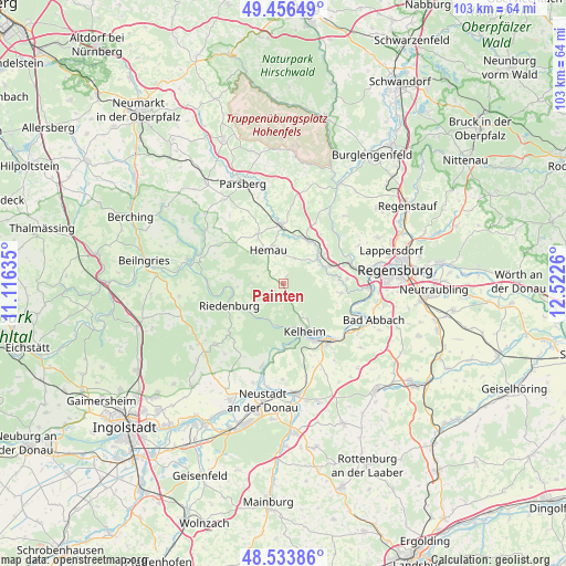
Painten GPS coordinates[2]
48° 59' 50.316" North, 11° 49' 10.092" East
| Map corner | latitude | longitude |
|---|---|---|
| Upper-left | 49.45649°, | 11.11635° |
| Center: | 48.99731°, | 11.81947° |
| Lower-right: | 48.53386°, | 12.5226° |
| Map W x H: | 102.6×102.6 km | = 63.8×63.8mi |
| max Lat: | 55.01917° ⇑83.1% North |
| Painten: | 48.99731° |
| min Lat: | ⇓16.9% South 47.40724° |
| min Long | Painten | max Long |
| 5.92978° | 11.81947° | 14.98853° |
| W 79.1%⇐ | ⇒20.9% E |
Elevation
Elevation of Painten is 507 m = 1663 ft, and this is 257.9 m = 846 ft above average elevation for this country.
| Max E: |
1256 m = 4121 ft | 10.6% |
| Painten | 507 m 1663 ft | |
| Avg. | 249.1 m = 817 ft | |
Min E: |
-5 m = -16 ft | 89.4% |
See also: Germany elevation on elevation.city.
Geographical zone
Painten is located in North temperate zone (between Tropic of Cancer and the Arctic Circle). Distance of this North polar circle is 1953.2 km =1213.7 mi to North.| Distance of | km | miles | from Painten |
|---|---|---|---|
| North Pole | 4559.1 | 2832.9 | to North |
| Arctic Circle | 1953.2 | 1213.7 | to North |
| Tropic Cancer | 2842.1 | 1766 | to South |
| Equator | 5448 | 3385.2 | to South |


Nearby cities:
15 places around Painten: (largest is in red/bold)
• Beratzhausen
10.9 km =6.8 mi,  356°
356°
• Brunn
12.8 km =8 mi,  27°
27°
• Deuerling
8 km =5 mi,  56°
56°
• Duggendorf
15 km =9.3 mi, 28°
• Essing
7.3 km =4.5 mi,  197°
197°
• Hemau
6.9 km =4.3 mi,  336°
336°
• Ihrlerstein
7.9 km =4.9 mi,  154°
154°
• Kelheim
10.1 km =6.3 mi, 151°
• Nittendorf
10.8 km =6.7 mi,  73°
73°
• Pettendorf
15.4 km =9.6 mi, 62°
• Pielenhofen
13 km =8.1 mi,  50°
50°
• Riedenburg
10.2 km =6.3 mi,  248°
248°
• Saal
13.5 km =8.4 mi,  142°
142°
• Sinzing
15.6 km =9.7 mi,  88°
88°
• Wolfsegg
16.8 km =10.4 mi,  43°
43°
Sources, notices
• [Note1] Compared only with cities in Germany existing in our database
• [Src1] Map data: © OpenStreetMap contributors (CC-BY-SA)
• [Src2] Other city data from geonames.org with taken over terms of usage.
• [Src3] Geographical zone / Annual Mean Temperature by Robert A. Rohde @ Wikipedia
