Hemau geodata
Hemau (Bavaria) is a populated place; located in Germany in Europe/Berlin (GMT+2) time zone. With population of 8,627 people, there are 1852 cities with bigger population in this country. Compared to other cities in Germany, 82.4% of cities are located further ↑North; 78.5% of cities are located further ←West and 89.7% of cities have lower elevation than Hemau. Note1
Administrative division(s):
- Level 1: Bavaria
- Level 2: Upper Palatinate
- Level 3: Landkreis Regensburg
- Level 4: Hemau


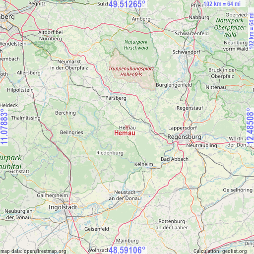
Hemau GPS coordinates[2]
49° 3' 14.364" North, 11° 46' 55.02" East
| Map corner | latitude | longitude |
|---|---|---|
| Upper-left | 49.51265°, | 11.07883° |
| Center: | 49.05399°, | 11.78195° |
| Lower-right: | 48.59106°, | 12.48508° |
| Map W x H: | 102.5×102.5 km | = 63.7×63.7mi |
| max Lat: | 55.01917° ⇑82.4% North |
| Hemau: | 49.05399° |
| min Lat: | ⇓17.6% South 47.40724° |
| min Long | Hemau | max Long |
| 5.92978° | 11.78195° | 14.98853° |
| W 78.5%⇐ | ⇒21.5% E |
Elevation
Elevation of Hemau is 510 m = 1673 ft, and this is 260.9 m = 856 ft above average elevation for this country.
| Max E: |
1256 m = 4121 ft | 10.3% |
| Hemau | 510 m 1673 ft | |
| Avg. | 249.1 m = 817 ft | |
Min E: |
-5 m = -16 ft | 89.7% |
See also: Germany elevation on elevation.city.
Geographical zone
Hemau is located in North temperate zone (between Tropic of Cancer and the Arctic Circle). Distance of this North polar circle is 1946.9 km =1209.7 mi to North.| Distance of | km | miles | from Hemau |
|---|---|---|---|
| North Pole | 4552.8 | 2829 | to North |
| Arctic Circle | 1946.9 | 1209.7 | to North |
| Tropic Cancer | 2848.4 | 1769.9 | to South |
| Equator | 5454.3 | 3389.1 | to South |


Nearby cities:
15 places around Hemau: (largest is in red/bold)
• Beratzhausen
5 km =3.1 mi,  23°
23°
• Brunn
10 km =6.2 mi,  59°
59°
• Deuerling
9.5 km =5.9 mi,  101°
101°
• Dietfurt
14.4 km =8.9 mi,  261°
261°
• Duggendorf
12 km =7.5 mi,  54°
54°
• Essing
13.3 km =8.3 mi,  177°
177°
• Ihrlerstein
14.8 km =9.2 mi,  155°
155°
• Lupburg
11.4 km =7.1 mi,  350°
350°
• Nittendorf
13.5 km =8.4 mi, 104°
• Painten
6.9 km =4.3 mi, 156°
• Parsberg
12.7 km =7.9 mi,  338°
338°
• Pettendorf
16.5 km =10.3 mi,  87°
87°
• Pielenhofen
12.9 km =8 mi,  80°
80°
• Riedenburg
12.1 km =7.5 mi,  214°
214°
• Wolfsegg
15.5 km =9.6 mi,  67°
67°
Sources, notices
• [Note1] Compared only with cities in Germany existing in our database
• [Src1] Map data: © OpenStreetMap contributors (CC-BY-SA)
• [Src2] Other city data from geonames.org with taken over terms of usage.
• [Src3] Geographical zone / Annual Mean Temperature by Robert A. Rohde @ Wikipedia
