Duggendorf geodata
Duggendorf (Bavaria) is a seat of a fourth-order administrative division; located in Germany in Europe/Berlin (GMT+2) time zone. With population of 1,605 people, there are 5676 cities with bigger population in this country. Compared to other cities in Germany, 81.5% of cities are located further ↑North; 80.5% of cities are located further ←West and 85.3% of cities have lower elevation than Duggendorf. Note1
Administrative division(s):
- Level 1: Bavaria
- Level 2: Upper Palatinate
- Level 3: Landkreis Regensburg
- Level 4: Duggendorf


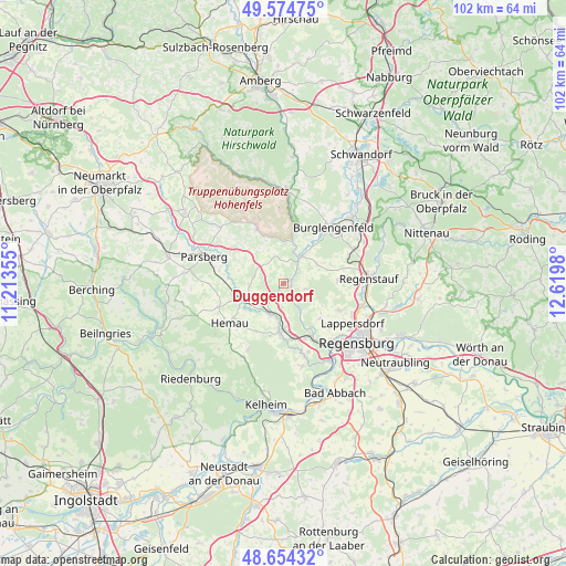
Duggendorf GPS coordinates[2]
49° 7' 0.012" North, 11° 55' 0.012" East
| Map corner | latitude | longitude |
|---|---|---|
| Upper-left | 49.57475°, | 11.21355° |
| Center: | 49.11667°, | 11.91667° |
| Lower-right: | 48.65432°, | 12.6198° |
| Map W x H: | 102.3×102.3 km | = 63.6×63.6mi |
| max Lat: | 55.01917° ⇑81.5% North |
| Duggendorf: | 49.11667° |
| min Lat: | ⇓18.5% South 47.40724° |
| min Long | Duggendorf | max Long |
| 5.92978° | 11.91667° | 14.98853° |
| W 80.5%⇐ | ⇒19.5% E |
Elevation
Elevation of Duggendorf is 472 m = 1549 ft, and this is 222.9 m = 731 ft above average elevation for this country.
| Max E: |
1256 m = 4121 ft | 14.7% |
| Duggendorf | 472 m 1549 ft | |
| Avg. | 249.1 m = 817 ft | |
Min E: |
-5 m = -16 ft | 85.3% |
See also: Germany elevation on elevation.city.
Geographical zone
Duggendorf is located in North temperate zone (between Tropic of Cancer and the Arctic Circle). Distance of this North polar circle is 1939.9 km =1205.4 mi to North.| Distance of | km | miles | from Duggendorf |
|---|---|---|---|
| North Pole | 4545.8 | 2824.6 | to North |
| Arctic Circle | 1939.9 | 1205.4 | to North |
| Tropic Cancer | 2855.3 | 1774.2 | to South |
| Equator | 5461.3 | 3393.5 | to South |


Nearby cities:
15 places around Duggendorf: (largest is in red/bold)
• Beratzhausen
8.1 km =5 mi,  252°
252°
• Brunn
2.2 km =1.4 mi,  213°
213°
• Burglengenfeld
13.4 km =8.3 mi,  43°
43°
• Deuerling
8.8 km =5.5 mi,  182°
182°
• Hemau
12 km =7.5 mi,  234°
234°
• Hohenfels
10.9 km =6.8 mi,  332°
332°
• Kallmünz
5.9 km =3.7 mi,  32°
32°
• Lappersdorf
14.9 km =9.3 mi,  121°
121°
• Lupburg
12.4 km =7.7 mi,  290°
290°
• Nittendorf
10.7 km =6.6 mi,  162°
162°
• Painten
15 km =9.3 mi, 208°
• Pettendorf
9.1 km =5.7 mi,  133°
133°
• Pielenhofen
5.7 km =3.5 mi,  149°
149°
• Wolfsegg
4.6 km =2.9 mi,  103°
103°
• Zeitlarn
14.8 km =9.2 mi,  106°
106°
Sources, notices
• [Note1] Compared only with cities in Germany existing in our database
• [Src1] Map data: © OpenStreetMap contributors (CC-BY-SA)
• [Src2] Other city data from geonames.org with taken over terms of usage.
• [Src3] Geographical zone / Annual Mean Temperature by Robert A. Rohde @ Wikipedia
