Ottenhofen geodata
Ottenhofen (Bavaria) is a seat of a fourth-order administrative division; located in Germany in Europe/Berlin (GMT+2) time zone. With population of 1,720 people, there are 5473 cities with bigger population in this country. Compared to other cities in Germany, 92.5% of cities are located further ↑North; 80% of cities are located further ←West and 87.6% of cities have lower elevation than Ottenhofen. Note1
Administrative division(s):
- Level 1: Bavaria
- Level 2: Upper Bavaria
- Level 3: Landkreis Erding
- Level 4: Ottenhofen


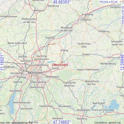
Ottenhofen GPS coordinates[2]
48° 13' 0.012" North, 11° 52' 59.988" East
| Map corner | latitude | longitude |
|---|---|---|
| Upper-left | 48.68303°, | 11.18021° |
| Center: | 48.21667°, | 11.88333° |
| Lower-right: | 47.74602°, | 12.58646° |
| Map W x H: | 104.2×104.2 km | = 64.7×64.7mi |
| max Lat: | 55.01917° ⇑92.5% North |
| Ottenhofen: | 48.21667° |
| min Lat: | ⇓7.5% South 47.40724° |
| min Long | Ottenhofen | max Long |
| 5.92978° | 11.88333° | 14.98853° |
| W 80%⇐ | ⇒20% E |
Elevation
Elevation of Ottenhofen is 490 m = 1608 ft, and this is 240.9 m = 790 ft above average elevation for this country.
| Max E: |
1256 m = 4121 ft | 12.4% |
| Ottenhofen | 490 m 1608 ft | |
| Avg. | 249.1 m = 817 ft | |
Min E: |
-5 m = -16 ft | 87.6% |
See also: Germany elevation on elevation.city.
Geographical zone
Ottenhofen is located in North temperate zone (between Tropic of Cancer and the Arctic Circle). Distance of this North polar circle is 2040 km =1267.6 mi to North.| Distance of | km | miles | from Ottenhofen |
|---|---|---|---|
| North Pole | 4645.9 | 2886.8 | to North |
| Arctic Circle | 2040 | 1267.6 | to North |
| Tropic Cancer | 2755.3 | 1712.1 | to South |
| Equator | 5361.2 | 3331.3 | to South |


Nearby cities:
15 places around Ottenhofen: (largest is in red/bold)
• Anzing
7.6 km =4.7 mi,  197°
197°
• Buch am Buchrain
8.3 km =5.2 mi,  91°
91°
• Eichenried
10.1 km =6.3 mi,  312°
312°
• Erding
10.1 km =6.3 mi,  9°
9°
• Finsing
4.4 km =2.7 mi,  269°
269°
• Forstern
7.9 km =4.9 mi,  117°
117°
• Forstinning
5.8 km =3.6 mi,  157°
157°
• Markt Schwaben
3.2 km =2 mi, 199°
• Moosinning
7.3 km =4.5 mi,  336°
336°
• Pastetten
4.9 km =3 mi,  113°
113°
• Pliening
6.6 km =4.1 mi,  249°
249°
• Poing
7.1 km =4.4 mi,  222°
222°
• Stammham
8.9 km =5.5 mi,  353°
353°
• Walpertskirchen
8.2 km =5.1 mi,  55°
55°
• Wörth
3.5 km =2.2 mi,  23°
23°
Sources, notices
• [Note1] Compared only with cities in Germany existing in our database
• [Src1] Map data: © OpenStreetMap contributors (CC-BY-SA)
• [Src2] Other city data from geonames.org with taken over terms of usage.
• [Src3] Geographical zone / Annual Mean Temperature by Robert A. Rohde @ Wikipedia
