Stammham geodata
Stammham (Bavaria) is a populated place; located in Germany in Europe/Berlin (GMT+2) time zone. With population of 3,487 people, there are 3622 cities with bigger population in this country. Compared to other cities in Germany, 91.3% of cities are located further ↑North; 79.9% of cities are located further ←West and 86% of cities have lower elevation than Stammham. Note1
Administrative division(s):
- Level 1: Bavaria
- Level 2: Upper Bavaria
- Level 3: Landkreis Erding
- Level 4: Moosinning


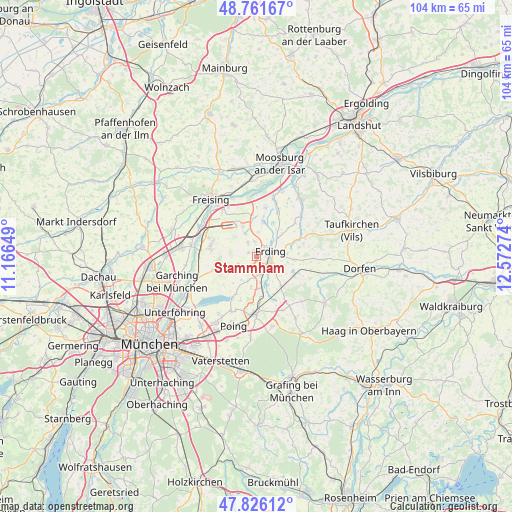
Stammham GPS coordinates[2]
48° 17' 45.744" North, 11° 52' 10.596" East
| Map corner | latitude | longitude |
|---|---|---|
| Upper-left | 48.76167°, | 11.16649° |
| Center: | 48.29604°, | 11.86961° |
| Lower-right: | 47.82612°, | 12.57274° |
| Map W x H: | 104×104 km | = 64.6×64.6mi |
| max Lat: | 55.01917° ⇑91.3% North |
| Stammham: | 48.29604° |
| min Lat: | ⇓8.7% South 47.40724° |
| min Long | Stammham | max Long |
| 5.92978° | 11.86961° | 14.98853° |
| W 79.9%⇐ | ⇒20.1% E |
Elevation
Elevation of Stammham is 478 m = 1568 ft, and this is 228.9 m = 751 ft above average elevation for this country.
| Max E: |
1256 m = 4121 ft | 14% |
| Stammham | 478 m 1568 ft | |
| Avg. | 249.1 m = 817 ft | |
Min E: |
-5 m = -16 ft | 86% |
See also: Germany elevation on elevation.city.
Geographical zone
Stammham is located in North temperate zone (between Tropic of Cancer and the Arctic Circle). Distance of this North polar circle is 2031.2 km =1262.1 mi to North.| Distance of | km | miles | from Stammham |
|---|---|---|---|
| North Pole | 4637 | 2881.3 | to North |
| Arctic Circle | 2031.2 | 1262.1 | to North |
| Tropic Cancer | 2764.1 | 1717.5 | to South |
| Equator | 5370 | 3336.8 | to South |


Nearby cities:
15 places around Stammham: (largest is in red/bold)
• Berglern
10.8 km =6.7 mi,  24°
24°
• Bockhorn
8.9 km =5.5 mi,  76°
76°
• Eichenried
6.8 km =4.2 mi,  252°
252°
• Eitting
7.2 km =4.5 mi,  12°
12°
• Erding
3 km =1.9 mi,  68°
68°
• Finsing
9.5 km =5.9 mi,  200°
200°
• Hallbergmoos
9.4 km =5.8 mi,  291°
291°
• Markt Schwaben
11.8 km =7.3 mi,  180°
180°
• Moosinning
2.8 km =1.7 mi,  221°
221°
• Oberding
2.7 km =1.7 mi,  327°
327°
• Ottenhofen
8.9 km =5.5 mi,  173°
173°
• Pastetten
12.1 km =7.5 mi,  153°
153°
• Pliening
12.3 km =7.6 mi, 204°
• Walpertskirchen
8.9 km =5.5 mi,  118°
118°
• Wörth
6.1 km =3.8 mi,  156°
156°
Sources, notices
• [Note1] Compared only with cities in Germany existing in our database
• [Src1] Map data: © OpenStreetMap contributors (CC-BY-SA)
• [Src2] Other city data from geonames.org with taken over terms of usage.
• [Src3] Geographical zone / Annual Mean Temperature by Robert A. Rohde @ Wikipedia
