Hänigsen geodata
Hänigsen (Lower Saxony) is a populated place; located in Germany in Europe/Berlin (GMT+2) time zone. With population of 6,033 people, there are 2449 cities with bigger population in this country. Compared to other cities in Germany, 77.3% of cities are located further ↓South; 51.6% of cities are located further ←West and 79.2% of cities have higher elevation than Hänigsen. Note1


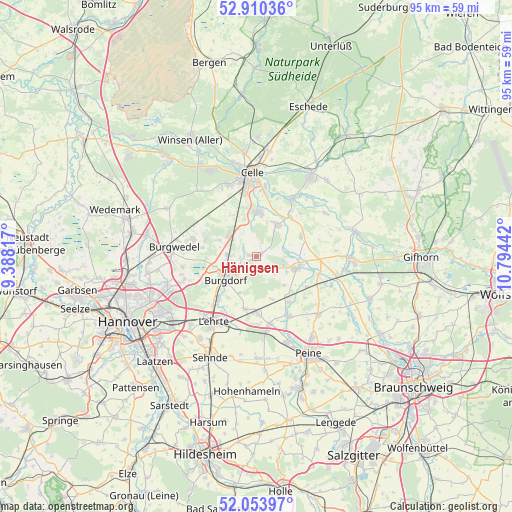
Hänigsen GPS coordinates[2]
52° 29' 3.3" North, 10° 5' 28.644" East
| Map corner | latitude | longitude |
|---|---|---|
| Upper-left | 52.91036°, | 9.38817° |
| Center: | 52.48425°, | 10.09129° |
| Lower-right: | 52.05397°, | 10.79442° |
| Map W x H: | 95.2×95.2 km | = 59.2×59.2mi |
| max Lat: | 55.01917° ⇑22.7% North |
| Hänigsen: | 52.48425° |
| min Lat: | ⇓77.3% South 47.40724° |
| min Long | Hänigsen | max Long |
| 5.92978° | 10.09129° | 14.98853° |
| W 51.6%⇐ | ⇒48.4% E |
Elevation
Elevation of Hänigsen is 49 m = 161 ft, and this is 200.1 m = 656 ft below average elevation for this country.
| Max E: |
1256 m = 4121 ft | 79.2% |
| Avg. | 249.1 m = 817 ft | |
| Hänigsen | 49 m = 161 ft | |
Min E: |
-5 m = -16 ft | 20.8% |
See also: Germany elevation on elevation.city.
Geographical zone
Hänigsen is located in North temperate zone (between Tropic of Cancer and the Arctic Circle). Distance of this North polar circle is 1565.5 km =972.8 mi to North.| Distance of | km | miles | from Hänigsen |
|---|---|---|---|
| North Pole | 4171.4 | 2592 | to North |
| Arctic Circle | 1565.5 | 972.8 | to North |
| Tropic Cancer | 3229.8 | 2006.9 | to South |
| Equator | 5835.7 | 3626.1 | to South |


Nearby cities:
15 places around Hänigsen: (largest is in red/bold)
• Adelheidsdorf
9.1 km =5.7 mi,  346°
346°
• Altmerdingsen
3.4 km =2.1 mi,  130°
130°
• Arpke
10.9 km =6.8 mi,  176°
176°
• Bröckel
9.1 km =5.7 mi,  66°
66°
• Burgdorf
7.1 km =4.4 mi,  233°
233°
• Dollbergen
10.5 km =6.5 mi,  144°
144°
• Eicklingen
9.7 km =6 mi,  40°
40°
• Langlingen
15.2 km =9.4 mi,  58°
58°
• Lehrte
14.6 km =9.1 mi,  211°
211°
• Nienhagen
8.1 km =5 mi,  5°
5°
• Schwüblingsen
8.6 km =5.3 mi,  159°
159°
• Uetze
8 km =5 mi,  105°
105°
• Wathlingen
7.1 km =4.4 mi,  34°
34°
• Wehnsen
13.4 km =8.3 mi,  119°
119°
• Wienhausen
12.5 km =7.8 mi, 31°
Sources, notices
• [Note1] Compared only with cities in Germany existing in our database
• [Src1] Map data: © OpenStreetMap contributors (CC-BY-SA)
• [Src2] Other city data from geonames.org with taken over terms of usage.
• [Src3] Geographical zone / Annual Mean Temperature by Robert A. Rohde @ Wikipedia
