Luckau geodata
Luckau (Brandenburg) is a populated place; located in Germany in Europe/Berlin (GMT+2) time zone. With population of 10,471 people, there are 1573 cities with bigger population in this country. Compared to other cities in Germany, 70.5% of cities are located further ↓South; 96.9% of cities are located further ←West and 75% of cities have higher elevation than Luckau. Note1


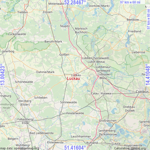
Luckau GPS coordinates[2]
51° 51' 8.82" North, 13° 42' 26.46" East
| Map corner | latitude | longitude |
|---|---|---|
| Upper-left | 52.28467°, | 13.00423° |
| Center: | 51.85245°, | 13.70735° |
| Lower-right: | 51.41604°, | 14.41048° |
| Map W x H: | 96.6×96.6 km | = 60×60mi |
| max Lat: | 55.01917° ⇑29.5% North |
| Luckau: | 51.85245° |
| min Lat: | ⇓70.5% South 47.40724° |
| min Long | Luckau | max Long |
| 5.92978° | 13.70735° | 14.98853° |
| W 96.9%⇐ | ⇒3.1% E |
Elevation
Elevation of Luckau is 63 m = 207 ft, and this is 186.1 m = 611 ft below average elevation for this country.
| Max E: |
1256 m = 4121 ft | 75% |
| Avg. | 249.1 m = 817 ft | |
| Luckau | 63 m = 207 ft | |
Min E: |
-5 m = -16 ft | 25% |
See also: Germany elevation on elevation.city.
Geographical zone
Luckau is located in North temperate zone (between Tropic of Cancer and the Arctic Circle). Distance of this North polar circle is 1635.7 km =1016.4 mi to North.| Distance of | km | miles | from Luckau |
|---|---|---|---|
| North Pole | 4241.6 | 2635.6 | to North |
| Arctic Circle | 1635.7 | 1016.4 | to North |
| Tropic Cancer | 3159.5 | 1963.2 | to South |
| Equator | 5765.5 | 3582.5 | to South |


Nearby cities:
15 places around Luckau: (largest is in red/bold)
• Bronkow
25.2 km =15.7 mi,  145°
145°
• Calau
20.8 km =12.9 mi,  125°
125°
• Crinitz
13.9 km =8.6 mi,  162°
162°
• Dahme
19.3 km =12 mi,  275°
275°
• Drahnsdorf
11.1 km =6.9 mi,  309°
309°
• Finsterwalde
24.3 km =15.1 mi,  180°
180°
• Golßen
15.2 km =9.4 mi,  331°
331°
• Hohenbucko
19.1 km =11.9 mi,  240°
240°
• Kasel-Golzig
9 km =5.6 mi,  356°
356°
• Lebusa
20.7 km =12.9 mi,  252°
252°
• Lübben
15.6 km =9.7 mi,  52°
52°
• Lübbenau
16.8 km =10.4 mi,  86°
86°
• Schlepzig
24.1 km =15 mi,  33°
33°
• Schönewalde
20.6 km =12.8 mi,  200°
200°
• Sonnewalde
18.3 km =11.4 mi,  193°
193°
Sources, notices
• [Note1] Compared only with cities in Germany existing in our database
• [Src1] Map data: © OpenStreetMap contributors (CC-BY-SA)
• [Src2] Other city data from geonames.org with taken over terms of usage.
• [Src3] Geographical zone / Annual Mean Temperature by Robert A. Rohde @ Wikipedia
