Hohenbucko geodata
Hohenbucko (Brandenburg) is a seat of a fourth-order administrative division; located in Germany in Europe/Berlin (GMT+2) time zone. With population of 721 people, there are 8230 cities with bigger population in this country. Compared to other cities in Germany, 69.6% of cities are located further ↓South; 95.5% of cities are located further ←West and 63.2% of cities have higher elevation than Hohenbucko. Note1


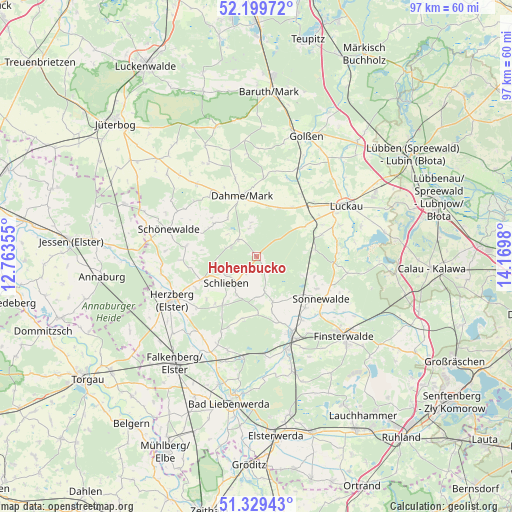
Hohenbucko GPS coordinates[2]
51° 46' 0.012" North, 13° 28' 0.012" East
| Map corner | latitude | longitude |
|---|---|---|
| Upper-left | 52.19972°, | 12.76355° |
| Center: | 51.76667°, | 13.46667° |
| Lower-right: | 51.32943°, | 14.1698° |
| Map W x H: | 96.8×96.8 km | = 60.1×60.1mi |
| max Lat: | 55.01917° ⇑30.4% North |
| Hohenbucko: | 51.76667° |
| min Lat: | ⇓69.6% South 47.40724° |
| min Long | Hohenbucko | max Long |
| 5.92978° | 13.46667° | 14.98853° |
| W 95.5%⇐ | ⇒4.5% E |
Elevation
Elevation of Hohenbucko is 131 m = 430 ft, and this is 118.1 m = 387 ft below average elevation for this country.
| Max E: |
1256 m = 4121 ft | 63.2% |
| Avg. | 249.1 m = 817 ft | |
| Hohenbucko | 131 m = 430 ft | |
Min E: |
-5 m = -16 ft | 36.8% |
See also: Germany elevation on elevation.city.
Geographical zone
Hohenbucko is located in North temperate zone (between Tropic of Cancer and the Arctic Circle). Distance of this North polar circle is 1645.3 km =1022.3 mi to North.| Distance of | km | miles | from Hohenbucko |
|---|---|---|---|
| North Pole | 4251.1 | 2641.5 | to North |
| Arctic Circle | 1645.3 | 1022.3 | to North |
| Tropic Cancer | 3150 | 1957.3 | to South |
| Equator | 5755.9 | 3576.5 | to South |


Nearby cities:
15 places around Hohenbucko: (largest is in red/bold)
• Crinitz
21 km =13 mi,  100°
100°
• Dahme
11.8 km =7.3 mi,  346°
346°
• Doberlug-Kirchhain
17 km =10.6 mi,  157°
157°
• Drahnsdorf
18.5 km =11.5 mi,  25°
25°
• Finsterwalde
22.2 km =13.8 mi,  131°
131°
• Herzberg
19.2 km =11.9 mi,  242°
242°
• Ihlow
14.3 km =8.9 mi,  321°
321°
• Lebusa
4.5 km =2.8 mi, 315°
• Luckau
19.1 km =11.9 mi,  60°
60°
• Schilda
19.4 km =12.1 mi,  197°
197°
• Schlieben
7.5 km =4.7 mi,  230°
230°
• Schönborn
18.6 km =11.6 mi,  175°
175°
• Schönewalde
13.5 km =8.4 mi,  136°
136°
• Sonnewalde
14.9 km =9.3 mi,  123°
123°
• Tröbitz
18.7 km =11.6 mi,  187°
187°
Sources, notices
• [Note1] Compared only with cities in Germany existing in our database
• [Src1] Map data: © OpenStreetMap contributors (CC-BY-SA)
• [Src2] Other city data from geonames.org with taken over terms of usage.
• [Src3] Geographical zone / Annual Mean Temperature by Robert A. Rohde @ Wikipedia
