Lohmar geodata
Lohmar (North Rhine-Westphalia) is a populated place; located in Germany in Europe/Berlin (GMT+2) time zone. With population of 31,339 people, there are 442 cities with bigger population in this country. Compared to other cities in Germany, 55% of cities are located further ↓South; 91.2% of cities are located further →East and 72.1% of cities have higher elevation than Lohmar. Note1
Administrative division(s):
- Level 1: North Rhine-Westphalia
- Level 2: Regierungsbezirk Köln
- Level 3: Rhein-Sieg-Kreis
- Level 4: Lohmar


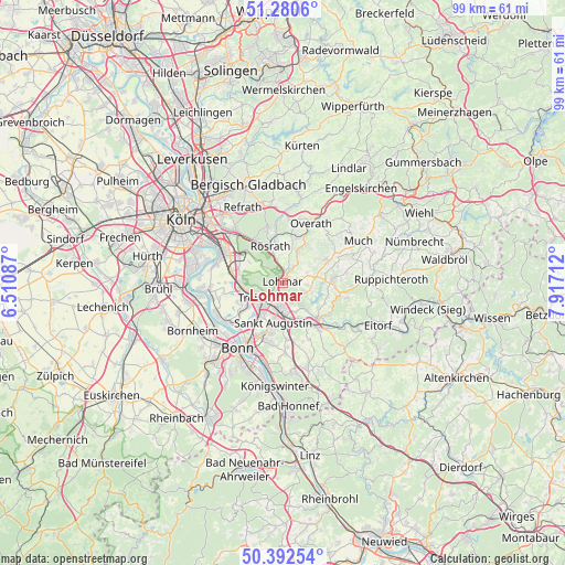
Lohmar GPS coordinates[2]
50° 50' 19.248" North, 7° 12' 50.364" East
| Map corner | latitude | longitude |
|---|---|---|
| Upper-left | 51.2806°, | 6.51087° |
| Center: | 50.83868°, | 7.21399° |
| Lower-right: | 50.39254°, | 7.91712° |
| Map W x H: | 98.7×98.7 km | = 61.3×61.3mi |
| max Lat: | 55.01917° ⇑45% North |
| Lohmar: | 50.83868° |
| min Lat: | ⇓55% South 47.40724° |
| min Long | Lohmar | max Long |
| 5.92978° | 7.21399° | 14.98853° |
| W 8.8%⇐ | ⇒91.2% E |
Elevation
Elevation of Lohmar is 77 m = 253 ft, and this is 172.1 m = 565 ft below average elevation for this country.
| Max E: |
1256 m = 4121 ft | 72.1% |
| Avg. | 249.1 m = 817 ft | |
| Lohmar | 77 m = 253 ft | |
Min E: |
-5 m = -16 ft | 27.9% |
See also: Germany elevation on elevation.city.
Geographical zone
Lohmar is located in North temperate zone (between Tropic of Cancer and the Arctic Circle). Distance of this North polar circle is 1748.4 km =1086.4 mi to North.| Distance of | km | miles | from Lohmar |
|---|---|---|---|
| North Pole | 4354.3 | 2705.6 | to North |
| Arctic Circle | 1748.4 | 1086.4 | to North |
| Tropic Cancer | 3046.8 | 1893.2 | to South |
| Equator | 5652.7 | 3512.4 | to South |


Nearby cities:
15 places around Lohmar: (largest is in red/bold)
• Bonn
14.3 km =8.9 mi,  215°
215°
• Eil
11.2 km =7 mi,  302°
302°
• Gremberghoven
12.8 km =8 mi, 303°
• Hennef
8.5 km =5.3 mi,  145°
145°
• Much
15.1 km =9.4 mi,  61°
61°
• Niederkassel
12.7 km =7.9 mi,  258°
258°
• Overath
11.6 km =7.2 mi,  25°
25°
• Porz am Rhein
12.1 km =7.5 mi, 295°
• Rath
12.7 km =7.9 mi,  318°
318°
• Rösrath
6.7 km =4.2 mi,  340°
340°
• Sankt Augustin
7.1 km =4.4 mi,  189°
189°
• Siegburg
4.3 km =2.7 mi, 185°
• Stoßdorf
6.8 km =4.2 mi,  157°
157°
• Troisdorf
5.6 km =3.5 mi,  233°
233°
• Wahn-Heide
7.9 km =4.9 mi,  286°
286°
Sources, notices
• [Note1] Compared only with cities in Germany existing in our database
• [Src1] Map data: © OpenStreetMap contributors (CC-BY-SA)
• [Src2] Other city data from geonames.org with taken over terms of usage.
• [Src3] Geographical zone / Annual Mean Temperature by Robert A. Rohde @ Wikipedia
