Königsfeld geodata
Königsfeld (Saxony) is a seat of a fourth-order administrative division; located in Germany in Europe/Berlin (GMT+2) time zone. With population of 1,770 people, there are 5397 cities with bigger population in this country. Compared to other cities in Germany, 59.3% of cities are located further ↓South; 90.3% of cities are located further ←West and 51.1% of cities have lower elevation than Königsfeld. Note1


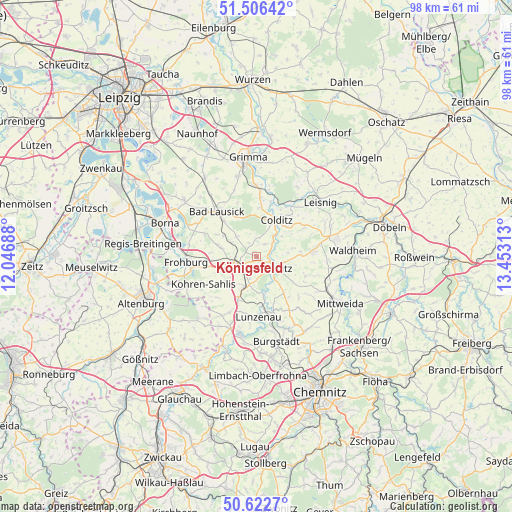
Königsfeld GPS coordinates[2]
51° 4' 0.012" North, 12° 45' 0" East
| Map corner | latitude | longitude |
|---|---|---|
| Upper-left | 51.50642°, | 12.04688° |
| Center: | 51.06667°, | 12.75° |
| Lower-right: | 50.6227°, | 13.45313° |
| Map W x H: | 98.3×98.3 km | = 61.1×61.1mi |
| max Lat: | 55.01917° ⇑40.7% North |
| Königsfeld: | 51.06667° |
| min Lat: | ⇓59.3% South 47.40724° |
| min Long | Königsfeld | max Long |
| 5.92978° | 12.75° | 14.98853° |
| W 90.3%⇐ | ⇒9.7% E |
Elevation
Elevation of Königsfeld is 234 m = 768 ft, and this is 15.1 m = 50 ft below average elevation for this country.
| Max E: |
1256 m = 4121 ft | 48.9% |
| Avg. | 249.1 m = 817 ft | |
| Königsfeld | 234 m = 768 ft | |
Min E: |
-5 m = -16 ft | 51.1% |
See also: Germany elevation on elevation.city.
Geographical zone
Königsfeld is located in North temperate zone (between Tropic of Cancer and the Arctic Circle). Distance of this North polar circle is 1723.1 km =1070.7 mi to North.| Distance of | km | miles | from Königsfeld |
|---|---|---|---|
| North Pole | 4329 | 2689.9 | to North |
| Arctic Circle | 1723.1 | 1070.7 | to North |
| Tropic Cancer | 3072.2 | 1909 | to South |
| Equator | 5678.1 | 3528.2 | to South |


Nearby cities:
15 places around Königsfeld: (largest is in red/bold)
• Bad Lausick
11.4 km =7.1 mi,  319°
319°
• Colditz
7.8 km =4.8 mi,  28°
28°
• Erlau
15.1 km =9.4 mi,  114°
114°
• Frohburg
13.5 km =8.4 mi,  265°
265°
• Geithain
3.9 km =2.4 mi,  251°
251°
• Geringswalde
11 km =6.8 mi,  84°
84°
• Gersdorf
14.1 km =8.8 mi,  69°
69°
• Großbothen
13.5 km =8.4 mi,  0°
0°
• Lunzenau
11.6 km =7.2 mi,  177°
177°
• Narsdorf
6 km =3.7 mi,  202°
202°
• Rochlitz
3.8 km =2.4 mi,  119°
119°
• Seelitz
6 km =3.7 mi,  128°
128°
• Wechselburg
7.4 km =4.6 mi,  165°
165°
• Zettlitz
5.8 km =3.6 mi,  90°
90°
• Zschadrass
9.3 km =5.8 mi, 30°
Sources, notices
• [Note1] Compared only with cities in Germany existing in our database
• [Src1] Map data: © OpenStreetMap contributors (CC-BY-SA)
• [Src2] Other city data from geonames.org with taken over terms of usage.
• [Src3] Geographical zone / Annual Mean Temperature by Robert A. Rohde @ Wikipedia
