Jävenitz geodata
Jävenitz (Saxony-Anhalt) is a populated place; located in Germany in Europe/Berlin (GMT+2) time zone. With population of 1,194 people, there are 6580 cities with bigger population in this country. Compared to other cities in Germany, 77.7% of cities are located further ↓South; 74.2% of cities are located further ←West and 74.5% of cities have higher elevation than Jävenitz. Note1
Administrative division(s):
- Level 1: Saxony-Anhalt
- Level 3: Altmarkkreis Salzwedel
- Level 4: Gardelegen


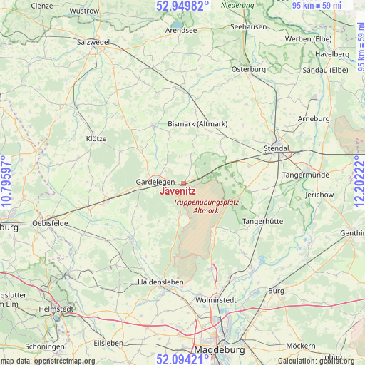
Jävenitz GPS coordinates[2]
52° 31' 26.76" North, 11° 29' 56.724" East
| Map corner | latitude | longitude |
|---|---|---|
| Upper-left | 52.94982°, | 10.79597° |
| Center: | 52.5241°, | 11.49909° |
| Lower-right: | 52.09421°, | 12.20222° |
| Map W x H: | 95.1×95.1 km | = 59.1×59.1mi |
| max Lat: | 55.01917° ⇑22.3% North |
| Jävenitz: | 52.5241° |
| min Lat: | ⇓77.7% South 47.40724° |
| min Long | Jävenitz | max Long |
| 5.92978° | 11.49909° | 14.98853° |
| W 74.2%⇐ | ⇒25.8% E |
Elevation
Elevation of Jävenitz is 65 m = 213 ft, and this is 184.1 m = 604 ft below average elevation for this country.
| Max E: |
1256 m = 4121 ft | 74.5% |
| Avg. | 249.1 m = 817 ft | |
| Jävenitz | 65 m = 213 ft | |
Min E: |
-5 m = -16 ft | 25.5% |
See also: Germany elevation on elevation.city.
Geographical zone
Jävenitz is located in North temperate zone (between Tropic of Cancer and the Arctic Circle). Distance of this North polar circle is 1561 km =970 mi to North.| Distance of | km | miles | from Jävenitz |
|---|---|---|---|
| North Pole | 4166.9 | 2589.2 | to North |
| Arctic Circle | 1561 | 970 | to North |
| Tropic Cancer | 3234.2 | 2009.6 | to South |
| Equator | 5840.1 | 3628.9 | to South |


Nearby cities:
15 places around Jävenitz: (largest is in red/bold)
• Badingen
13.5 km =8.4 mi,  45°
45°
• Berge
9.3 km =5.8 mi,  289°
289°
• Bismark
15.8 km =9.8 mi,  14°
14°
• Dolle
15.4 km =9.6 mi,  146°
146°
• Engersen
15.1 km =9.4 mi,  314°
314°
• Gardelegen
7 km =4.3 mi,  270°
270°
• Insel
17.7 km =11 mi,  76°
76°
• Kalbe
16.6 km =10.3 mi,  332°
332°
• Kloster Neuendorf
2.4 km =1.5 mi, 274°
• Kläden
16.2 km =10.1 mi,  42°
42°
• Letzlingen
8.7 km =5.4 mi,  186°
186°
• Lindstedt
7.8 km =4.8 mi,  15°
15°
• Lüderitz
16.6 km =10.3 mi,  95°
95°
• Solpke
14.5 km =9 mi,  261°
261°
• Uchtspringe
7 km =4.3 mi, 75°
Sources, notices
• [Note1] Compared only with cities in Germany existing in our database
• [Src1] Map data: © OpenStreetMap contributors (CC-BY-SA)
• [Src2] Other city data from geonames.org with taken over terms of usage.
• [Src3] Geographical zone / Annual Mean Temperature by Robert A. Rohde @ Wikipedia
