Uchtspringe geodata
Uchtspringe (Saxony-Anhalt) is a populated place; located in Germany in Europe/Berlin (GMT+2) time zone. With population of 1,487 people, there are 5912 cities with bigger population in this country. Compared to other cities in Germany, 77.9% of cities are located further ↓South; 75.7% of cities are located further ←West and 72.8% of cities have higher elevation than Uchtspringe. Note1


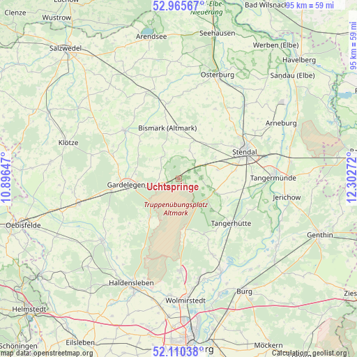
Uchtspringe GPS coordinates[2]
52° 32' 24.396" North, 11° 35' 58.524" East
| Map corner | latitude | longitude |
|---|---|---|
| Upper-left | 52.96567°, | 10.89647° |
| Center: | 52.54011°, | 11.59959° |
| Lower-right: | 52.11038°, | 12.30272° |
| Map W x H: | 95.1×95.1 km | = 59.1×59.1mi |
| max Lat: | 55.01917° ⇑22.1% North |
| Uchtspringe: | 52.54011° |
| min Lat: | ⇓77.9% South 47.40724° |
| min Long | Uchtspringe | max Long |
| 5.92978° | 11.59959° | 14.98853° |
| W 75.7%⇐ | ⇒24.3% E |
Elevation
Elevation of Uchtspringe is 73 m = 240 ft, and this is 176.1 m = 578 ft below average elevation for this country.
| Max E: |
1256 m = 4121 ft | 72.8% |
| Avg. | 249.1 m = 817 ft | |
| Uchtspringe | 73 m = 240 ft | |
Min E: |
-5 m = -16 ft | 27.2% |
See also: Germany elevation on elevation.city.
Geographical zone
Uchtspringe is located in North temperate zone (between Tropic of Cancer and the Arctic Circle). Distance of this North polar circle is 1559.3 km =968.9 mi to North.| Distance of | km | miles | from Uchtspringe |
|---|---|---|---|
| North Pole | 4165.1 | 2588.1 | to North |
| Arctic Circle | 1559.3 | 968.9 | to North |
| Tropic Cancer | 3236 | 2010.8 | to South |
| Equator | 5841.9 | 3630 | to South |


Nearby cities:
15 places around Uchtspringe: (largest is in red/bold)
• Badingen
8.2 km =5.1 mi,  20°
20°
• Berge
15.6 km =9.7 mi,  274°
274°
• Bismark
13.9 km =8.6 mi,  347°
347°
• Burgstall
16 km =9.9 mi,  155°
155°
• Dahlen
15.5 km =9.6 mi,  81°
81°
• Dolle
14.7 km =9.1 mi,  173°
173°
• Gardelegen
13.9 km =8.6 mi,  263°
263°
• Insel
10.7 km =6.6 mi, 76°
• Jävenitz
7 km =4.3 mi, 255°
• Kloster Neuendorf
9.3 km =5.8 mi, 260°
• Kläden
11 km =6.8 mi, 21°
• Letzlingen
13 km =8.1 mi,  216°
216°
• Lindstedt
7.4 km =4.6 mi,  320°
320°
• Lüderitz
10.3 km =6.4 mi,  109°
109°
• Möringen
11.4 km =7.1 mi,  60°
60°
Sources, notices
• [Note1] Compared only with cities in Germany existing in our database
• [Src1] Map data: © OpenStreetMap contributors (CC-BY-SA)
• [Src2] Other city data from geonames.org with taken over terms of usage.
• [Src3] Geographical zone / Annual Mean Temperature by Robert A. Rohde @ Wikipedia
