Bruchköbel geodata
Bruchköbel (Hesse) is a populated place; located in Germany in Europe/Berlin (GMT+2) time zone. With population of 20,892 people, there are 732 cities with bigger population in this country. Compared to other cities in Germany, 59.5% of cities are located further ↑North; 66.4% of cities are located further →East and 65.7% of cities have higher elevation than Bruchköbel. Note1
Administrative division(s):
- Level 1: Hesse
- Level 2: Regierungsbezirk Darmstadt
- Level 3: Main-Kinzig-Kreis
- Level 4: Bruchköbel


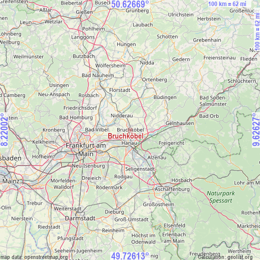
Bruchköbel GPS coordinates[2]
50° 10' 42.708" North, 8° 55' 23.34" East
| Map corner | latitude | longitude |
|---|---|---|
| Upper-left | 50.62669°, | 8.22002° |
| Center: | 50.17853°, | 8.92315° |
| Lower-right: | 49.72613°, | 9.62627° |
| Map W x H: | 100.1×100.1 km | = 62.2×62.2mi |
| max Lat: | 55.01917° ⇑59.5% North |
| Bruchköbel: | 50.17853° |
| min Lat: | ⇓40.5% South 47.40724° |
| min Long | Bruchköbel | max Long |
| 5.92978° | 8.92315° | 14.98853° |
| W 33.6%⇐ | ⇒66.4% E |
Elevation
Elevation of Bruchköbel is 116 m = 381 ft, and this is 133.1 m = 437 ft below average elevation for this country.
| Max E: |
1256 m = 4121 ft | 65.7% |
| Avg. | 249.1 m = 817 ft | |
| Bruchköbel | 116 m = 381 ft | |
Min E: |
-5 m = -16 ft | 34.3% |
See also: Germany elevation on elevation.city.
Geographical zone
Bruchköbel is located in North temperate zone (between Tropic of Cancer and the Arctic Circle). Distance of this North polar circle is 1821.8 km =1132 mi to North.| Distance of | km | miles | from Bruchköbel |
|---|---|---|---|
| North Pole | 4427.7 | 2751.2 | to North |
| Arctic Circle | 1821.8 | 1132 | to North |
| Tropic Cancer | 2973.4 | 1847.6 | to South |
| Equator | 5579.3 | 3466.8 | to South |


Nearby cities:
15 places around Bruchköbel: (largest is in red/bold)
• Altenstadt
12.2 km =7.6 mi,  6°
6°
• Bad Vilbel
13.2 km =8.2 mi,  270°
270°
• Erlensee
4.3 km =2.7 mi,  113°
113°
• Großkrotzenburg
11.4 km =7.1 mi,  157°
157°
• Hammersbach
6 km =3.7 mi,  45°
45°
• Hanau am Main
5 km =3.1 mi,  187°
187°
• Kahl am Main
13.4 km =8.3 mi,  154°
154°
• Karben
12.2 km =7.6 mi,  298°
298°
• Langenselbold
8.3 km =5.2 mi,  91°
91°
• Maintal
7.1 km =4.4 mi,  243°
243°
• Mühlheim am Main
9.4 km =5.8 mi,  222°
222°
• Nidderau
7.7 km =4.8 mi,  328°
328°
• Niederdorfelden
8.9 km =5.5 mi,  281°
281°
• Obertshausen
13 km =8.1 mi,  203°
203°
• Rodenbach
8.5 km =5.3 mi, 112°
Sources, notices
• [Note1] Compared only with cities in Germany existing in our database
• [Src1] Map data: © OpenStreetMap contributors (CC-BY-SA)
• [Src2] Other city data from geonames.org with taken over terms of usage.
• [Src3] Geographical zone / Annual Mean Temperature by Robert A. Rohde @ Wikipedia
