Gompertshausen geodata
Gompertshausen (Thuringia) is a seat of a fourth-order administrative division; located in Germany in Europe/Berlin (GMT+2) time zone. With population of 601 people, there are 8817 cities with bigger population in this country. Compared to other cities in Germany, 56.9% of cities are located further ↑North; 61.3% of cities are located further ←West and 64.3% of cities have lower elevation than Gompertshausen. Note1
Administrative division(s):
- Level 1: Thuringia
- Level 3: Landkreis Hildburghausen
- Level 4: Stadt Heldburg


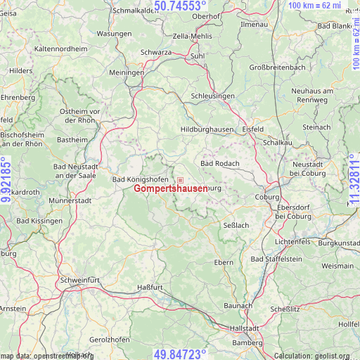
Gompertshausen GPS coordinates[2]
50° 17' 54.6" North, 10° 37' 29.928" East
| Map corner | latitude | longitude |
|---|---|---|
| Upper-left | 50.74553°, | 9.92185° |
| Center: | 50.2985°, | 10.62498° |
| Lower-right: | 49.84723°, | 11.32811° |
| Map W x H: | 99.9×99.9 km | = 62.1×62.1mi |
| max Lat: | 55.01917° ⇑56.9% North |
| Gompertshausen: | 50.2985° |
| min Lat: | ⇓43.1% South 47.40724° |
| min Long | Gompertshausen | max Long |
| 5.92978° | 10.62498° | 14.98853° |
| W 61.3%⇐ | ⇒38.7% E |
Elevation
Elevation of Gompertshausen is 317 m = 1040 ft, and this is 67.9 m = 223 ft above average elevation for this country.
| Max E: |
1256 m = 4121 ft | 35.7% |
| Gompertshausen | 317 m 1040 ft | |
| Avg. | 249.1 m = 817 ft | |
Min E: |
-5 m = -16 ft | 64.3% |
See also: Germany elevation on elevation.city.
Geographical zone
Gompertshausen is located in North temperate zone (between Tropic of Cancer and the Arctic Circle). Distance of this North polar circle is 1808.5 km =1123.7 mi to North.| Distance of | km | miles | from Gompertshausen |
|---|---|---|---|
| North Pole | 4414.4 | 2743 | to North |
| Arctic Circle | 1808.5 | 1123.7 | to North |
| Tropic Cancer | 2986.7 | 1855.8 | to South |
| Equator | 5592.7 | 3475.1 | to South |


Nearby cities:
15 places around Gompertshausen: (largest is in red/bold)
• Aubstadt
14.1 km =8.8 mi,  285°
285°
• Bad Königshofen im Grabfeld
11.1 km =6.9 mi,  271°
271°
• Bundorf
11.9 km =7.4 mi,  220°
220°
• Dingsleben
15.1 km =9.4 mi,  353°
353°
• Ermershausen
10 km =6.2 mi,  179°
179°
• Gleichamberg
8.2 km =5.1 mi, 346°
• Hellingen
6.8 km =4.2 mi,  142°
142°
• Herbstadt
9.7 km =6 mi, 293°
• Höchheim
14.5 km =9 mi,  301°
301°
• Maroldsweisach
11.7 km =7.3 mi,  167°
167°
• Milz
10.8 km =6.7 mi,  324°
324°
• Römhild
12.5 km =7.8 mi,  330°
330°
• Trappstadt
4.5 km =2.8 mi, 300°
• Ummerstadt
14 km =8.7 mi,  108°
108°
• Westhausen
3.3 km =2.1 mi,  54°
54°
Sources, notices
• [Note1] Compared only with cities in Germany existing in our database
• [Src1] Map data: © OpenStreetMap contributors (CC-BY-SA)
• [Src2] Other city data from geonames.org with taken over terms of usage.
• [Src3] Geographical zone / Annual Mean Temperature by Robert A. Rohde @ Wikipedia
