Gersheim geodata
Gersheim (Saarland) is a seat of a fourth-order administrative division; located in Germany in Europe/Berlin (GMT+2) time zone. With population of 7,264 people, there are 2125 cities with bigger population in this country. Compared to other cities in Germany, 81.2% of cities are located further ↑North; 91.4% of cities are located further →East and 54.5% of cities have lower elevation than Gersheim. Note1


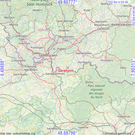
Gersheim GPS coordinates[2]
49° 9' 0" North, 7° 12' 0" East
| Map corner | latitude | longitude |
|---|---|---|
| Upper-left | 49.60777°, | 6.49688° |
| Center: | 49.15°, | 7.2° |
| Lower-right: | 48.68796°, | 7.90313° |
| Map W x H: | 102.3×102.3 km | = 63.6×63.6mi |
| max Lat: | 55.01917° ⇑81.2% North |
| Gersheim: | 49.15° |
| min Lat: | ⇓18.8% South 47.40724° |
| min Long | Gersheim | max Long |
| 5.92978° | 7.2° | 14.98853° |
| W 8.6%⇐ | ⇒91.4% E |
Elevation
Elevation of Gersheim is 255 m = 837 ft, and this is 5.9 m = 19 ft above average elevation for this country.
| Max E: |
1256 m = 4121 ft | 45.5% |
| Gersheim | 255 m 837 ft | |
| Avg. | 249.1 m = 817 ft | |
Min E: |
-5 m = -16 ft | 54.5% |
See also: Germany elevation on elevation.city.
Geographical zone
Gersheim is located in North temperate zone (between Tropic of Cancer and the Arctic Circle). Distance of this North polar circle is 1936.2 km =1203.1 mi to North.| Distance of | km | miles | from Gersheim |
|---|---|---|---|
| North Pole | 4542.1 | 2822.3 | to North |
| Arctic Circle | 1936.2 | 1203.1 | to North |
| Tropic Cancer | 2859 | 1776.5 | to South |
| Equator | 5465 | 3395.8 | to South |


Nearby cities:
15 places around Gersheim: (largest is in red/bold)
• Althornbach
14.1 km =8.8 mi,  64°
64°
• Blieskastel
10.5 km =6.5 mi,  22°
22°
• Dietrichingen
16.2 km =10.1 mi,  76°
76°
• Großsteinhausen
18.5 km =11.5 mi, 78°
• Hornbach
13 km =8.1 mi,  71°
71°
• Kirkel
15 km =9.3 mi,  9°
9°
• Kleinblittersdorf
11.9 km =7.4 mi,  274°
274°
• Mauschbach
15 km =9.3 mi, 75°
• Riedelberg
18.5 km =11.5 mi, 78°
• Rimschweiler
14.9 km =9.3 mi, 59°
• Saarbrücken
16.6 km =10.3 mi,  303°
303°
• Sankt Ingbert
15.4 km =9.6 mi,  336°
336°
• Spiesen-Elversberg
19.2 km =11.9 mi,  345°
345°
• Sulzbach
19.5 km =12.1 mi,  327°
327°
• Zweibrücken
16.4 km =10.2 mi,  48°
48°
Sources, notices
• [Note1] Compared only with cities in Germany existing in our database
• [Src1] Map data: © OpenStreetMap contributors (CC-BY-SA)
• [Src2] Other city data from geonames.org with taken over terms of usage.
• [Src3] Geographical zone / Annual Mean Temperature by Robert A. Rohde @ Wikipedia
