Georgensgmünd geodata
Georgensgmünd (Bavaria) is a seat of a fourth-order administrative division; located in Germany in Europe/Berlin (GMT+2) time zone. With population of 6,582 people, there are 2282 cities with bigger population in this country. Compared to other cities in Germany, 80.5% of cities are located further ↑North; 67.2% of cities are located further ←West and 70.1% of cities have lower elevation than Georgensgmünd. Note1
Administrative division(s):
- Level 1: Bavaria
- Level 2: Regierungsbezirk Mittelfranken
- Level 3: Landkreis Roth
- Level 4: Georgensgmünd


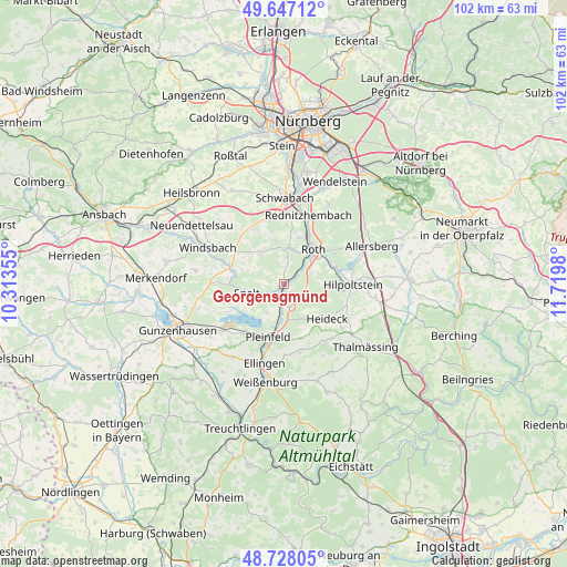
Georgensgmünd GPS coordinates[2]
49° 11' 22.992" North, 11° 1' 0.012" East
| Map corner | latitude | longitude |
|---|---|---|
| Upper-left | 49.64712°, | 10.31355° |
| Center: | 49.18972°, | 11.01667° |
| Lower-right: | 48.72805°, | 11.7198° |
| Map W x H: | 102.2×102.2 km | = 63.5×63.5mi |
| max Lat: | 55.01917° ⇑80.5% North |
| Georgensgmünd: | 49.18972° |
| min Lat: | ⇓19.5% South 47.40724° |
| min Long | Georgensgmünd | max Long |
| 5.92978° | 11.01667° | 14.98853° |
| W 67.2%⇐ | ⇒32.8% E |
Elevation
Elevation of Georgensgmünd is 359 m = 1178 ft, and this is 109.9 m = 361 ft above average elevation for this country.
| Max E: |
1256 m = 4121 ft | 29.9% |
| Georgensgmünd | 359 m 1178 ft | |
| Avg. | 249.1 m = 817 ft | |
Min E: |
-5 m = -16 ft | 70.1% |
See also: Germany elevation on elevation.city.
Geographical zone
Georgensgmünd is located in North temperate zone (between Tropic of Cancer and the Arctic Circle). Distance of this North polar circle is 1931.8 km =1200.4 mi to North.| Distance of | km | miles | from Georgensgmünd |
|---|---|---|---|
| North Pole | 4537.7 | 2819.6 | to North |
| Arctic Circle | 1931.8 | 1200.4 | to North |
| Tropic Cancer | 2863.5 | 1779.3 | to South |
| Equator | 5469.4 | 3398.5 | to South |


Nearby cities:
15 places around Georgensgmünd: (largest is in red/bold)
• Abenberg
7 km =4.3 mi,  327°
327°
• Absberg
11.1 km =6.9 mi,  242°
242°
• Bergen
14.7 km =9.1 mi,  151°
151°
• Büchenbach
9.2 km =5.7 mi,  19°
19°
• Ellingen
14.8 km =9.2 mi,  193°
193°
• Ettenstatt
12.8 km =8 mi,  167°
167°
• Heideck
10.2 km =6.3 mi,  127°
127°
• Hilpoltstein
12.6 km =7.8 mi,  89°
89°
• Höttingen
14.2 km =8.8 mi,  183°
183°
• Kammerstein
11.9 km =7.4 mi,  344°
344°
• Pleinfeld
9.8 km =6.1 mi, 194°
• Rednitzhembach
13.2 km =8.2 mi, 20°
• Roth
8.4 km =5.2 mi,  40°
40°
• Röttenbach
4.6 km =2.9 mi,  164°
164°
• Spalt
6.9 km =4.3 mi,  256°
256°
Sources, notices
• [Note1] Compared only with cities in Germany existing in our database
• [Src1] Map data: © OpenStreetMap contributors (CC-BY-SA)
• [Src2] Other city data from geonames.org with taken over terms of usage.
• [Src3] Geographical zone / Annual Mean Temperature by Robert A. Rohde @ Wikipedia
