Hilpoltstein geodata
Hilpoltstein (Bavaria) is a populated place; located in Germany in Europe/Berlin (GMT+2) time zone. With population of 13,069 people, there are 1233 cities with bigger population in this country. Compared to other cities in Germany, 80.5% of cities are located further ↑North; 69.8% of cities are located further ←West and 72.4% of cities have lower elevation than Hilpoltstein. Note1
Administrative division(s):
- Level 1: Bavaria
- Level 2: Regierungsbezirk Mittelfranken
- Level 3: Landkreis Roth
- Level 4: Hilpoltstein


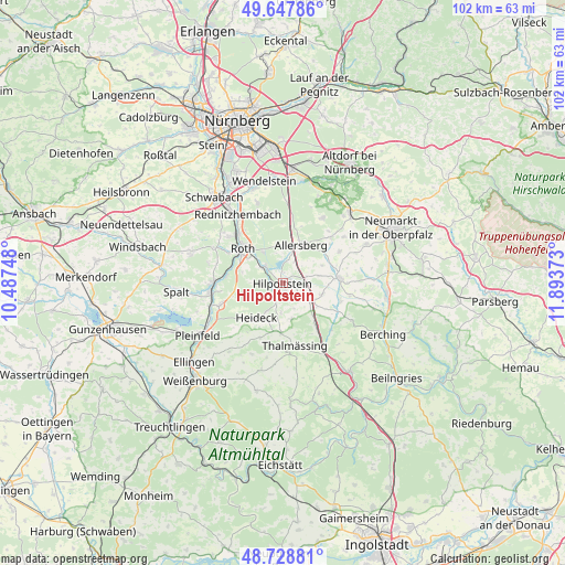
Hilpoltstein GPS coordinates[2]
49° 11' 25.692" North, 11° 11' 26.16" East
| Map corner | latitude | longitude |
|---|---|---|
| Upper-left | 49.64786°, | 10.48748° |
| Center: | 49.19047°, | 11.1906° |
| Lower-right: | 48.72881°, | 11.89373° |
| Map W x H: | 102.2×102.2 km | = 63.5×63.5mi |
| max Lat: | 55.01917° ⇑80.5% North |
| Hilpoltstein: | 49.19047° |
| min Lat: | ⇓19.5% South 47.40724° |
| min Long | Hilpoltstein | max Long |
| 5.92978° | 11.1906° | 14.98853° |
| W 69.8%⇐ | ⇒30.2% E |
Elevation
Elevation of Hilpoltstein is 377 m = 1237 ft, and this is 127.9 m = 420 ft above average elevation for this country.
| Max E: |
1256 m = 4121 ft | 27.6% |
| Hilpoltstein | 377 m 1237 ft | |
| Avg. | 249.1 m = 817 ft | |
Min E: |
-5 m = -16 ft | 72.4% |
See also: Germany elevation on elevation.city.
Geographical zone
Hilpoltstein is located in North temperate zone (between Tropic of Cancer and the Arctic Circle). Distance of this North polar circle is 1931.7 km =1200.3 mi to North.| Distance of | km | miles | from Hilpoltstein |
|---|---|---|---|
| North Pole | 4537.6 | 2819.5 | to North |
| Arctic Circle | 1931.7 | 1200.3 | to North |
| Tropic Cancer | 2863.5 | 1779.3 | to South |
| Equator | 5469.5 | 3398.6 | to South |


Nearby cities:
15 places around Hilpoltstein: (largest is in red/bold)
• Abenberg
17.5 km =10.9 mi,  289°
289°
• Allersberg
7.5 km =4.7 mi,  26°
26°
• Bergen
14.2 km =8.8 mi,  203°
203°
• Berngau
16.6 km =10.3 mi,  66°
66°
• Büchenbach
12.9 km =8 mi,  311°
311°
• Ettenstatt
16 km =9.9 mi,  218°
218°
• Freystadt
10.2 km =6.3 mi,  83°
83°
• Georgensgmünd
12.6 km =7.8 mi,  269°
269°
• Heideck
7.8 km =4.8 mi, 216°
• Nennslingen
16.5 km =10.3 mi, 195°
• Pyrbaum
13.7 km =8.5 mi, 30°
• Rednitzhembach
14.7 km =9.1 mi,  326°
326°
• Roth
9.6 km =6 mi, 311°
• Röttenbach
12.3 km =7.6 mi,  248°
248°
• Thalmässing
11.6 km =7.2 mi,  168°
168°
Sources, notices
• [Note1] Compared only with cities in Germany existing in our database
• [Src1] Map data: © OpenStreetMap contributors (CC-BY-SA)
• [Src2] Other city data from geonames.org with taken over terms of usage.
• [Src3] Geographical zone / Annual Mean Temperature by Robert A. Rohde @ Wikipedia
