Geisenfeld geodata
Geisenfeld (Bavaria) is a populated place; located in Germany in Europe/Berlin (GMT+2) time zone. With population of 9,769 people, there are 1660 cities with bigger population in this country. Compared to other cities in Germany, 86.6% of cities are located further ↑North; 75.9% of cities are located further ←West and 74.1% of cities have lower elevation than Geisenfeld. Note1
Administrative division(s):
- Level 1: Bavaria
- Level 2: Upper Bavaria
- Level 3: Landkreis Pfaffenhofen an der Ilm
- Level 4: Geisenfeld


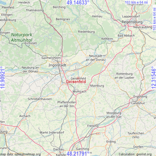
Geisenfeld GPS coordinates[2]
48° 41' 3.336" North, 11° 36' 44.388" East
| Map corner | latitude | longitude |
|---|---|---|
| Upper-left | 49.14633°, | 10.90921° |
| Center: | 48.68426°, | 11.61233° |
| Lower-right: | 48.21791°, | 12.31546° |
| Map W x H: | 103.2×103.2 km | = 64.1×64.1mi |
| max Lat: | 55.01917° ⇑86.6% North |
| Geisenfeld: | 48.68426° |
| min Lat: | ⇓13.4% South 47.40724° |
| min Long | Geisenfeld | max Long |
| 5.92978° | 11.61233° | 14.98853° |
| W 75.9%⇐ | ⇒24.1% E |
Elevation
Elevation of Geisenfeld is 390 m = 1280 ft, and this is 140.9 m = 462 ft above average elevation for this country.
| Max E: |
1256 m = 4121 ft | 25.9% |
| Geisenfeld | 390 m 1280 ft | |
| Avg. | 249.1 m = 817 ft | |
Min E: |
-5 m = -16 ft | 74.1% |
See also: Germany elevation on elevation.city.
Geographical zone
Geisenfeld is located in North temperate zone (between Tropic of Cancer and the Arctic Circle). Distance of this North polar circle is 1988 km =1235.3 mi to North.| Distance of | km | miles | from Geisenfeld |
|---|---|---|---|
| North Pole | 4593.9 | 2854.5 | to North |
| Arctic Circle | 1988 | 1235.3 | to North |
| Tropic Cancer | 2807.3 | 1744.4 | to South |
| Equator | 5413.2 | 3363.6 | to South |


Nearby cities:
15 places around Geisenfeld: (largest is in red/bold)
• Aiglsbach
7.1 km =4.4 mi,  82°
82°
• Baar-Ebenhausen
10.6 km =6.6 mi,  261°
261°
• Elsendorf
14.7 km =9.1 mi, 79°
• Ernsgaden
5.9 km =3.7 mi,  338°
338°
• Großmehring
10.8 km =6.7 mi,  327°
327°
• Karlskron
14.4 km =8.9 mi,  269°
269°
• Mainburg
13.3 km =8.3 mi,  110°
110°
• Manching
9.4 km =5.8 mi,  292°
292°
• Münchsmünster
10.5 km =6.5 mi,  29°
29°
• Pörnbach
13.1 km =8.1 mi,  234°
234°
• Reichertshofen
11.1 km =6.9 mi,  254°
254°
• Rohrbach
8.2 km =5.1 mi,  204°
204°
• Rudelzhausen
14.7 km =9.1 mi,  129°
129°
• Vohburg an der Donau
9.5 km =5.9 mi,  2°
2°
• Wolnzach
9 km =5.6 mi,  173°
173°
Sources, notices
• [Note1] Compared only with cities in Germany existing in our database
• [Src1] Map data: © OpenStreetMap contributors (CC-BY-SA)
• [Src2] Other city data from geonames.org with taken over terms of usage.
• [Src3] Geographical zone / Annual Mean Temperature by Robert A. Rohde @ Wikipedia
