Fürstenberg geodata
Fürstenberg (Brandenburg) is a populated place; located in Germany in Europe/Berlin (GMT+2) time zone. With population of 6,774 people, there are 2243 cities with bigger population in this country. Compared to other cities in Germany, 82.8% of cities are located further ↓South; 93.3% of cities are located further ←West and 77% of cities have higher elevation than Fürstenberg. Note1
Administrative division(s):
- Level 1: Brandenburg
- Level 3: Landkreis Oberhavel
- Level 4: Fürstenberg/Havel


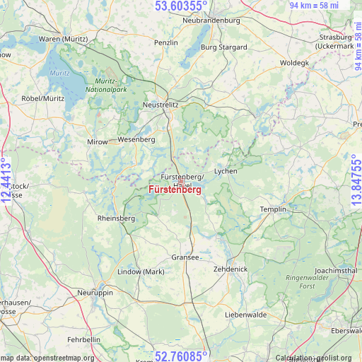
Fürstenberg GPS coordinates[2]
53° 11' 3.372" North, 13° 8' 39.912" East
| Map corner | latitude | longitude |
|---|---|---|
| Upper-left | 53.60355°, | 12.4413° |
| Center: | 53.18427°, | 13.14442° |
| Lower-right: | 52.76085°, | 13.84755° |
| Map W x H: | 93.7×93.7 km | = 58.2×58.2mi |
| max Lat: | 55.01917° ⇑17.2% North |
| Fürstenberg: | 53.18427° |
| min Lat: | ⇓82.8% South 47.40724° |
| min Long | Fürstenberg | max Long |
| 5.92978° | 13.14442° | 14.98853° |
| W 93.3%⇐ | ⇒6.7% E |
Elevation
Elevation of Fürstenberg is 56 m = 184 ft, and this is 193.1 m = 634 ft below average elevation for this country.
| Max E: |
1256 m = 4121 ft | 77% |
| Avg. | 249.1 m = 817 ft | |
| Fürstenberg | 56 m = 184 ft | |
Min E: |
-5 m = -16 ft | 23% |
See also: Germany elevation on elevation.city.
Geographical zone
Fürstenberg is located in North temperate zone (between Tropic of Cancer and the Arctic Circle). Distance of this North polar circle is 1487.6 km =924.4 mi to North.| Distance of | km | miles | from Fürstenberg |
|---|---|---|---|
| North Pole | 4093.5 | 2543.6 | to North |
| Arctic Circle | 1487.6 | 924.4 | to North |
| Tropic Cancer | 3307.6 | 2055.2 | to South |
| Equator | 5913.5 | 3674.5 | to South |


Nearby cities:
15 places around Fürstenberg: (largest is in red/bold)
• Blankensee
25.8 km =16 mi,  18°
18°
• Blumenholz
25.6 km =15.9 mi,  356°
356°
• Carpin
20.3 km =12.6 mi, 18°
• Gransee
19.7 km =12.2 mi,  177°
177°
• Großwoltersdorf
13.4 km =8.3 mi,  192°
192°
• Lychen
11.8 km =7.3 mi,  74°
74°
• Neustrelitz
20.2 km =12.6 mi,  346°
346°
• Rheinsberg
18.9 km =11.7 mi,  240°
240°
• Roggentin
24.1 km =15 mi,  313°
313°
• Schönermark
19.8 km =12.3 mi, 184°
• Sonnenberg
18.7 km =11.6 mi, 191°
• Templin
24.9 km =15.5 mi,  107°
107°
• Userin
20.4 km =12.7 mi,  327°
327°
• Wesenberg
15.8 km =9.8 mi, 312°
• Zehdenick
26.1 km =16.2 mi,  151°
151°
Sources, notices
• [Note1] Compared only with cities in Germany existing in our database
• [Src1] Map data: © OpenStreetMap contributors (CC-BY-SA)
• [Src2] Other city data from geonames.org with taken over terms of usage.
• [Src3] Geographical zone / Annual Mean Temperature by Robert A. Rohde @ Wikipedia
