Sonnenberg geodata
Sonnenberg (Brandenburg) is a seat of a fourth-order administrative division; located in Germany in Europe/Berlin (GMT+2) time zone. With population of 923 people, there are 7444 cities with bigger population in this country. Compared to other cities in Germany, 81.8% of cities are located further ↓South; 92.9% of cities are located further ←West and 73.8% of cities have higher elevation than Sonnenberg. Note1


Sonnenberg GPS coordinates[2]
53° 1' 9.012" North, 13° 5' 18.276" East
| Map corner | latitude | longitude |
|---|---|---|
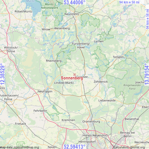
| Upper-left | 53.44006°, | 12.38529° |
| Center: | 53.01917°, | 13.08841° |
| Lower-right: | 52.59413°, | 13.79154° |
| Map W x H: | 94.1×94.1 km | = 58.5×58.5mi |
| max Lat: | 55.01917° ⇑18.2% North |
| Sonnenberg: | 53.01917° |
| min Lat: | ⇓81.8% South 47.40724° |
| min Long | Sonnenberg | max Long |
| 5.92978° | 13.08841° | 14.98853° |
| W 92.9%⇐ | ⇒7.1% E |
Elevation
Elevation of Sonnenberg is 68 m = 223 ft, and this is 181.1 m = 594 ft below average elevation for this country.
| Max E: |
1256 m = 4121 ft | 73.8% |
| Avg. | 249.1 m = 817 ft | |
| Sonnenberg | 68 m = 223 ft | |
Min E: |
-5 m = -16 ft | 26.2% |
See also: Germany elevation on elevation.city.
Geographical zone
Sonnenberg is located in North temperate zone (between Tropic of Cancer and the Arctic Circle). Distance of this North polar circle is 1506 km =935.8 mi to North.| Distance of | km | miles | from Sonnenberg |
|---|---|---|---|
| North Pole | 4111.9 | 2555 | to North |
| Arctic Circle | 1506 | 935.8 | to North |
| Tropic Cancer | 3289.3 | 2043.9 | to South |
| Equator | 5895.2 | 3663.1 | to South |


Nearby cities:
15 places around Sonnenberg: (largest is in red/bold)
• Dabergotz
27.6 km =17.1 mi,  242°
242°
• Fürstenberg
18.7 km =11.6 mi,  11°
11°
• Gransee
4.8 km =3 mi,  106°
106°
• Großwoltersdorf
5.3 km =3.3 mi, 8°
• Herzberg
15.2 km =9.4 mi,  211°
211°
• Kremmen
28.9 km =18 mi,  188°
188°
• Liebenwalde
26.3 km =16.3 mi,  128°
128°
• Lindow
9 km =5.6 mi,  229°
229°
• Lychen
26.3 km =16.3 mi,  35°
35°
• Neuruppin
21.6 km =13.4 mi, 242°
• Rheinsberg
15.5 km =9.6 mi,  305°
305°
• Rüthnick
16.5 km =10.3 mi,  201°
201°
• Schönermark
2.5 km =1.6 mi,  122°
122°
• Templin
29.8 km =18.5 mi,  68°
68°
• Zehdenick
16.9 km =10.5 mi, 105°
Sources, notices
• [Note1] Compared only with cities in Germany existing in our database
• [Src1] Map data: © OpenStreetMap contributors (CC-BY-SA)
• [Src2] Other city data from geonames.org with taken over terms of usage.
• [Src3] Geographical zone / Annual Mean Temperature by Robert A. Rohde @ Wikipedia
