Dietfurt geodata
Dietfurt (Bavaria) is a populated place; located in Germany in Europe/Berlin (GMT+2) time zone. With population of 6,161 people, there are 2409 cities with bigger population in this country. Compared to other cities in Germany, 82.6% of cities are located further ↑North; 75.6% of cities are located further ←West and 70.9% of cities have lower elevation than Dietfurt. Note1
Administrative division(s):
- Level 1: Bavaria
- Level 2: Upper Palatinate
- Level 3: Landkreis Neumarkt in der Oberpfalz
- Level 4: Dietfurt a.d.Altmühl


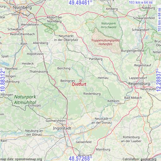
Dietfurt GPS coordinates[2]
49° 2' 8.808" North, 11° 35' 10.464" East
| Map corner | latitude | longitude |
|---|---|---|
| Upper-left | 49.49461°, | 10.88312° |
| Center: | 49.03578°, | 11.58624° |
| Lower-right: | 48.57268°, | 12.28937° |
| Map W x H: | 102.5×102.5 km | = 63.7×63.7mi |
| max Lat: | 55.01917° ⇑82.6% North |
| Dietfurt: | 49.03578° |
| min Lat: | ⇓17.4% South 47.40724° |
| min Long | Dietfurt | max Long |
| 5.92978° | 11.58624° | 14.98853° |
| W 75.6%⇐ | ⇒24.4% E |
Elevation
Elevation of Dietfurt is 365 m = 1198 ft, and this is 115.9 m = 380 ft above average elevation for this country.
| Max E: |
1256 m = 4121 ft | 29.1% |
| Dietfurt | 365 m 1198 ft | |
| Avg. | 249.1 m = 817 ft | |
Min E: |
-5 m = -16 ft | 70.9% |
See also: Germany elevation on elevation.city.
Geographical zone
Dietfurt is located in North temperate zone (between Tropic of Cancer and the Arctic Circle). Distance of this North polar circle is 1948.9 km =1211 mi to North.| Distance of | km | miles | from Dietfurt |
|---|---|---|---|
| North Pole | 4554.8 | 2830.2 | to North |
| Arctic Circle | 1948.9 | 1211 | to North |
| Tropic Cancer | 2846.3 | 1768.6 | to South |
| Equator | 5452.3 | 3387.9 | to South |


Nearby cities:
15 places around Dietfurt: (largest is in red/bold)
• Beratzhausen
17.6 km =10.9 mi,  67°
67°
• Berching
13.2 km =8.2 mi,  306°
306°
• Deining
21.4 km =13.3 mi,  350°
350°
• Denkendorf
15.2 km =9.4 mi,  218°
218°
• Essing
18.6 km =11.6 mi,  127°
127°
• Greding
16.8 km =10.4 mi,  274°
274°
• Hemau
14.4 km =8.9 mi,  81°
81°
• Lupburg
18.2 km =11.3 mi,  43°
43°
• Mindelstetten
21.2 km =13.2 mi,  167°
167°
• Mühlhausen
18 km =11.2 mi,  325°
325°
• Painten
17.5 km =10.9 mi,  104°
104°
• Parsberg
16.9 km =10.5 mi,  34°
34°
• Riedenburg
11 km =6.8 mi,  136°
136°
• Seubersdorf
14.4 km =8.9 mi,  11°
11°
• Stammham
22.2 km =13.8 mi,  205°
205°
Sources, notices
• [Note1] Compared only with cities in Germany existing in our database
• [Src1] Map data: © OpenStreetMap contributors (CC-BY-SA)
• [Src2] Other city data from geonames.org with taken over terms of usage.
• [Src3] Geographical zone / Annual Mean Temperature by Robert A. Rohde @ Wikipedia
